;

Civil War Blog

A project of PA Historian

List of Civil War Veterans from the Lykens Valley Area

Posted By on April 14, 2011

Georgraphic area of study for the Civil War Research Project of the Gratz Historical Society

The Civil War Research Project has just released a first draft version of a list of Civil War veterans who have some connection to the Lykens Valley area.  The list contains the names of more than 2000 persons who served in the Civil War.  The most common spelling of the name is used along with the approximate or known birth and death years of the veteran.  For each of the persons named in the list, there is a digital file in the Civil War Research Project.  The digital files contain a number of items for each veteran.  For some veterans, there are many items.  For others, there is only scant information.  Already, there are more than 50,000 records in the digital files.  The records could be in “jpeg” format, “pdf” format, or be Microsoft Word documents.  Essentially, the list is an “index” to the more than 2000 digital “file folders” in which the records are stored.

The list was compiled from many sources including veteran lists from the various centennial, sesquicentennial and bicentennial histories of the boroughs and townships within the geographic area of study; veterans organization lists; cemetery lists; family records; census returns (particularly the 1890 Veterans & Widow’s Census); pension records; military records; and from on-line resources including Ancestry.com and Find A Grave.

The plan is to publish an updated list each year through 2015 on 12 April, the anniversary of the start of the war.  Hopefully, by 12 April 2015, the list will be as complete as possible and will represent more than five years of cooperative research between and among thCivil War Research Project, families doing research on their relatives, and ohistorical society in the area.

The list is searchable within your browser’s search functions, but you must use the exact spelling of the surname as it appears in the list.  If you come up with no results for a particular surname, try various spellings.  The alphabetical sections are short enough that a visual search is relatively easy.

If you wish to print a copy of the list, highlight the names and copy and paste the information into a word processing program.  The list can be printed in about 20 pages, but that depends on the size font you select. Within a few weeks, information will be available on how to obtain a print copy of the list for those who don’t have access to a computer.

The Civil War Research Project continues to look for additional veterans who may have been left off the list and for thorough and complete information on every veteran who has been identified.  Some names may be on the list in error.  Others who have relatively common names may be listed once, when in fact the listing may represent several person.  Corrections and additions are always welcome!  Click here for the veterans listClick here to send information on specific veteransClick here to inquire about any of the veterans on the list.  To make specific comments about this post, use the dialog box below.

To access the list, click on the word “Veterans” on the blog toolbar.

Underground Railroad in Pennsylvania – Part 3 of 3

Posted By on April 13, 2011

On Monday, the post discussed Harrisburg as a “hub” of activity for the Underground Railroad, rather than a final destination as it was presented on Sunday.  Those escapees moving north from Harrisburg would have passed through and possibly stopped over in the Lykens Valley area as they made their way to Elmira, New York, and from there to Canada.  Part One also hypothesized that a black family in Gratz during the Civil War period could have have come north on an early Underground Railroad route.

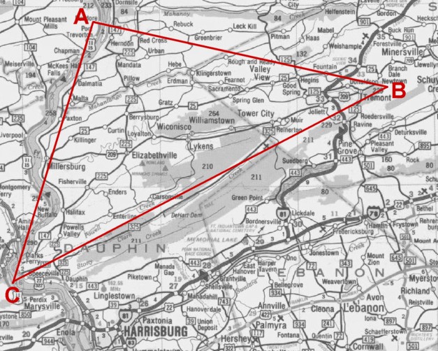
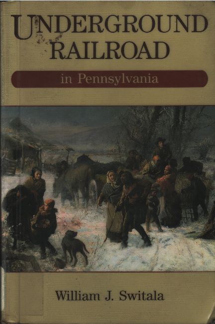
In his book, Underground Railroad in Pennsylvania, William J. Switala presents a map showing the northern route of escape from Harrisburg.  A portion of that map is presented below:

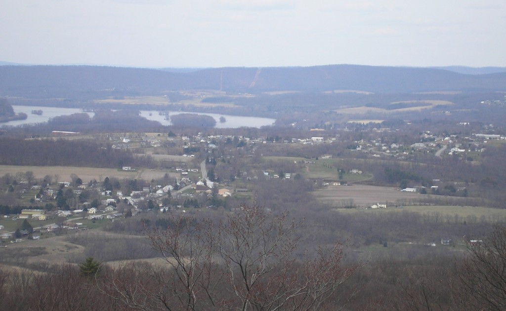
To Switala’s map, a red triangle has been added to represent the approximate area of this Civil War Research Project.  Noting from the map that most of the communities in north-central Pennsylvania have rich documentation that the Underground Railroad was very active there, and noting also, that there was a single route through the Lykens Valley area, it can be concluded that most, if not all the escapees using this central route passed through the Lykens Valley area.  Note also that the bends in the Susquehanna River are most noticable north of Peter’s Mountain (the bottom line of the triangle).  These bends can be seen in a recent photo taken from the Appalachian Trail lookouts in one of the hairpin turns at the top of Peter’s Mountain:

The Borough of Halifax, Dauphin County, lies in the valley.  The road winding down into Halifax is current Route 225, also known as Peter’s Mountain Road.  Not seen in this photo is the river road, Route 147, or the railroad, the former Northern Central line which wound its way up the river to Sunbury and thence by a different railroad, continued to Elmira, New York.  Sunbury, Northumberland County, Pennsylvania, lies on the eastern bank of the Susquehanna River opposite the town of Selinsgrove, and is not noted on the map.

On Switala’s map, the first Susquehanna River community north of the red triangle is Selinsgrove, which also has documented Underground Railroad activity.  The Governor Snyder Mansion in Selinsgrove, home of Simon Snyder a former Pennsylvania governor, was well-known as a “station.”

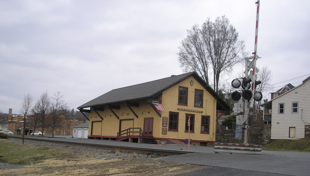
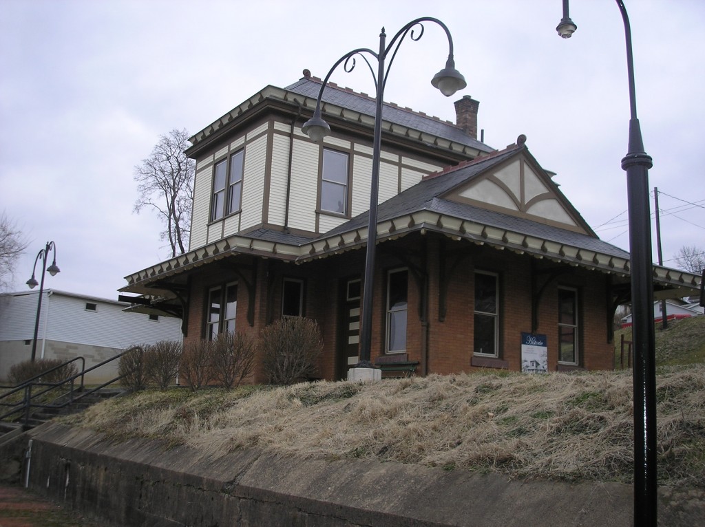
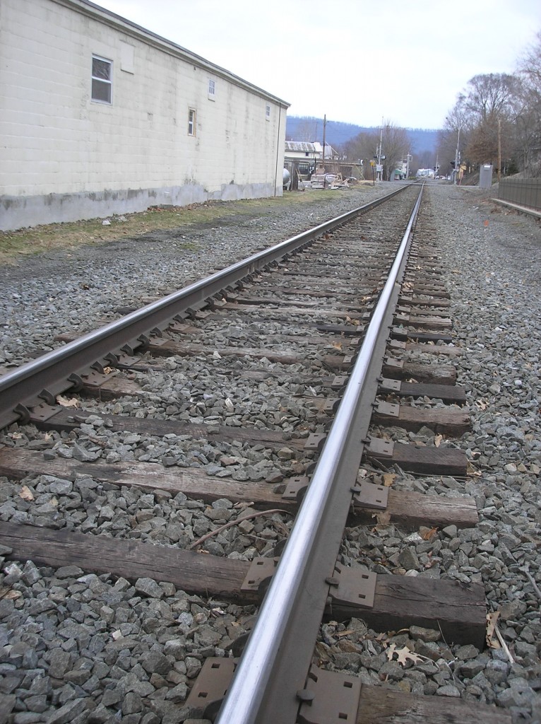
Getting through the Lykens Valley area was very easy since one of the most common methods of Underground Railroad travel was for the escapees to ride on the tops of railroad passenger cars at night.  Scheduled trains frequently stopped at stations at Halifax, Millersburg and Herndon on their way through to Sunbury.  The roadbed for the old Northern Central Railroad passes through the town of Millersburg, but the station there today is not the same one as in the Civil War era.  There is also an old freight station there as well – again, not the same one that was there during and before the Civil War.

The other ways of travel, as previously mentioned, were by foot path over Peter’s Mountain or along the river road.

Switala notes that communities all along up the Susquehanna River participated in the Underground Railroad but then fails to mention any of the communities in the Lykens Valley area or how they participated.

Surprisingly there is little evidence in the Lykens Valley area today that the Underground Railroad ever  passed through.  There are occasional family stories of helping escapees, but few African-American who passed through decided to stay.  We can only speculate why this was so.  Many areas of the country where there was heavy Underground Railroad activity have homes and barns with secret hiding places, wagons with false bottoms, and other evidence to prove existence.  Much research still needs to be done.

Anyone with additional information on Underground Railroad activities, “stations,” or hiding places is urged to contribute it.


Historic Millersburg Freight Station of the Northern Central Railroad. This is a post-Civil War station and is now the home of several Millersburg businesses. However, the track is in the same location as the "Underground Railroad" route to the north.

Historic Millersburg Passenger Station of the Pennsylvania Railroad. This station has been restored and is on the National Register of Historic Places. Although it is not the Civil War era station, the track in front is in the same location as the Northern Central Railroad track that was also part of the Underground Railroad.

Looking north along the old roadbed of the Northern Central Railroad in Millersburg, the path of escape for many African Americans heading to Elmira, New York, and Canada.

Fort Sumter – The War Begins

Posted By on April 12, 2011

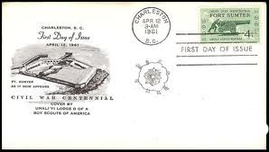
Fifty years ago, I was eagerly awaiting the release of the first of five United States stamp issues to recognize the Centennial of the Civil War.  A green four cent stamp was to be issued in Charleston, South Carolina, at Fort Sumter where the first shots were fired.  I was a junior in high school at the time, and taking the required first-year course in American history, which covered the years from the age of discovery to the end of the Civil War and Reconstruction.  In April, we were still studying the causes of the war and efforts to compromise on the slavery issue.  It was exciting to me that my first venture into a formal study of the Civil War coincided with the anniversary of its beginning.

My stamp collection was very small then, consisting only of single unused copies of the stamps I could afford to buy at the post office.  But for some reason, I decided to do more in collecting this new set of stamps.

A friend told me about “First Day Covers” and how you could send a self-addressed envelope to the postmaster at Charleston, along with the pennies to pay for the four cent stamp, and you would receive in return an envelope with a special “first day of issue cancellation” that would be both a souvenir and an investment.  I also learned that stamp collector shops, such as the one at Wanamakers in Philadelphia, sold “cacheted” envelopes that were specifically designed for each stamp issue, and that for a few pennies, I could buy one or more of those “cacheted” envelopes and use those instead of or in addition to the blank ones I planned to send to Charleston.  The “cachets” were commercially printed designs on the left side of the envelope that related to the stamp issue.  And so, about a week before the scheduled date for the issue of the stamp, I shipped twelve envelopes along with four dimes, a nickel and three pennies to the Charleston postmaster.

In those days, new stamps first went on sale in one city on the day of issue.  The second day, they were released nationwide.  I would have to wait another day to buy the stamps at my local post office – which I did.  The stamps were beautiful!  They were designed by Charles R. Chickering.  A few days later, the first day covers began to arrive.  The Fort Sumter stamp thus became the foundation of what would become an expanded, specialized collection of United States stamps.

The Civil War Centennial lasted into my junior year of college.  The collection continued to grow and for each of the new issues in the Civil War series, I prepared the self-addressed envelopes and mailed them to the postmaster in the first day city.  The “Rifleman at the Battle of Shiloh” was issued on 7 April 1962 at Shiloh, Tennessee.  The “Blue and Gray at Gettysburg” was issued on 1 July 1863 at Gettysburg, Pennsylvania.  The “Battle of the Wilderness” was issued on 5 May 1964 at Fredericksburg, Virginia.  And, finally, “Appomattox” was issued on 9 April 1865, at Appomattox, Virginia.

The “investment” part of collecting these stamps was bad advice.  It turns out that nearly 603,000 envelopes were canceled at Charleston with the “First Day of Issue” cancellation, hardly a “limited edition.”  and the total number of these four cent stamps that were issued exceeded 100,000,000.  But the interest that was sparked in me toward history and my continued study of the Civil War was an unexpected dividend.  I majored in history in college.  I taught history for many years.  And now, I’m enjoying researching and writing about the Civil War while chairing the Civil War Research Project.

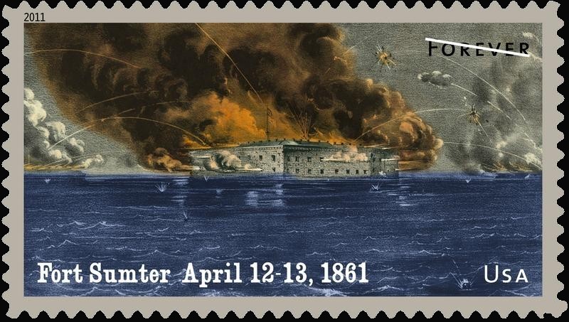
The United States Postal Service has announced stamp issues to celebrate 150th anniversary the beginning of the Civil War and naturally, there is a stamp for Fort Sumter.  I won’t be sending off envelopes this time to get the first day cancel because a few years ago I sold my whole collection.

It is doubtful that anyone with a connection to the Lykens Valley or the Civil War Research Project was present at Fort Sumter when it was fired upon and when the war officially began.  But surely the news appeared in the local newspapers.  A previous post entitled New Years Day 1861 presented some diagrams of the fort and dismissed the value of the fort in the overall Southern effort – a few Union ships could blockade the harbor and make the fort useless if the fort were lost.  By April, the situation had changed, and as a matter of honor, when the fort was fired upon and the U.S. flag hauled down, the war began.

The 2011 Fort Sumter stamp photo is from the USPS website.

Underground Railroad in Pennsylvania – Part 2 of 3

Posted By on April 11, 2011

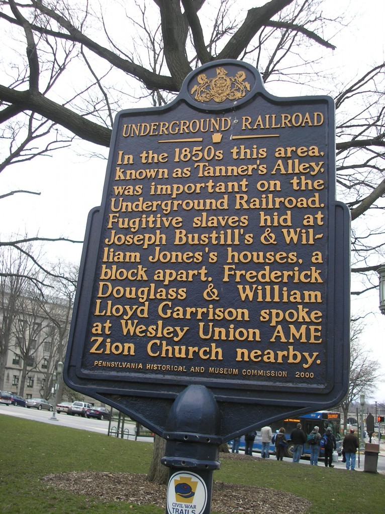
In the post yesterday, some basic information was given about the hidden network of escape routes known as the Underground Railroad.  The basic impression from the information given was that Harrisburg was a final destination for the African-Americans who got there.  Also, from the map given, there were no escape routes identified in central Pennsylvania which went beyond the capital.  On the grounds of the Capitol Building in Harrisburg is an historical marker for the Underground Railroad.  It reads:

Underground Railroad

In the 1850s this area known as Tanner’s Alley was important on the Underground Railroad.  Figitive slaves hid at Joseph Bustill’s and William Jones’s houses, a block apart.  Frederick Douglass and William Lloyd Garrison spoke at Wesley Union AME Church nearby.

In his book, The Underground Railroad in Pennsylvania, William J. Swatila quickly dispels the myth that Harrisburg was a final destination and refers to it as the “hub of the central route.”  In tracing the history of the city, he notes that the population of free blacks in 1860 was 1,709 out of a total population in Dauphin County of 45,047.  The Wesley Union Church (cited on the historical marker above), was located at Third and Mulberry Streets and also in the city was the Harrisburg Anti-Slavery Society.  The treatment of a local attorney charged with enforcing the Fugitive Slave Act bears testimony to Harrisburg’s emergence as a major, strategic hub in Pennsylvania and the nation in aiding escapees:

A Slave Commission office opened in Harrisburg after the passage of the Fugitive Slave Act of 1850.  Its commissioner was Richard McAllister, a local attorney.  He and his deputies became notorious for seizing blacks, both fugitives and free, and sending them south to be sold into bondage.  Eventually McAllister was forced to resigned because of the scandal surrounding him and his operations.  The Slave Commission office closed in 1853, and bias against blacks in Harrisburg began to abate.

Names of many Harrisburg residents who aided black escapees appear in the records – too numerous to name all in this post.  Many are mentioned in Swatila’s book.   They are a major reason for the prominence of Harrisburg in the history of the Underground Railroad.

But if Harrisburg had not also been a transportation hub, the city may not have been achieved the record of success that it did.  In a previous post on the “Crossroads of the Union,” the convergence of two railway lines – the Pennsylvania Railroad, which ran east and west through Harrisburg, and the Northern Central Railroad, which ran north and south through Harrisburg – were discussed.  This made Harrisburg a “natural” through route for the many lines of the Underground Railroad as well.  Switala notes:  “By the 1850s, the city had rail connections with Philadelphia, Reading, Pittsburgh, and Elmira, New York.  Because of all these options, four major exit routes emerged by which fugitive slaves could reach freedom.

The barrier to movement north was previously named as Peter’s Mountain.  What was not mentioned in yesterday’s post was that a major Indian trail, the Paxtang Path, went along the banks of the Susquehanna River from Harrisburg all the way to modern-day Sunbury.  Thus, even before the Northern Central Railroad was completed to Sunbury in the 1850s, the foot path was heavily traveled with escapees heading north to Canada.  Trails also existed over Peter’s Mountain, the primary one being at the location of the present-day Peter’s Mountain Road, also known as Route 225, which re-joins with the river road, Route 147, in Halifax, Dauphin County.

Switala’s book is an excellent resource for understanding the importance of Harrisburg in the history of the Underground Railroad, particularly in the routes through central Pennsylvania.  On Wednesday, the post will look at one of the northern routes which ran right through Dauphin and Northumberland Counties.

Underground Railroad in Pennsylvania – Part 1 of 3

Posted By on April 10, 2011

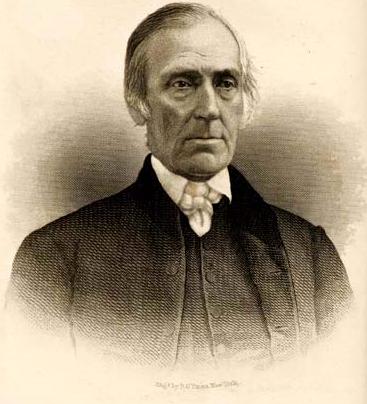
Levi Coffin (1798-1877) - "President" of the Underground Railroad

The Underground Railroad was the name given to a 19th century hidden network of routes by which African-Americans escaped from slavery to freedom – for the most part, to the north and to Canada.  Abolitionists aided the escaping African-Americans and established a series of safe-houses or hiding places along the way as well aiding the escapees to move from one stop to another – either under the cover of darkness, or hidden among cargo moving north, or in broad daylight disguised as travelers who normally would not be stopped.  The term “railroad” was used to describe the operation of moving “passengers” from “station” to “station” (or “depot” to “depot”).  The abolitionists who assisted were called “conductors.”  The “stationmasters” were those who assisted by providing hiding places in their homes or barns.  The state coordinators were referred to as “superintendents” and the overall national head was referred to as the “president.”  Many historians agree that the “president” of this operation was Levi Coffin (1798-1877) a Quaker abolitionist who was born in the south, but made his home in Indiana and Ohio while the Underground Railroad was at its peak.

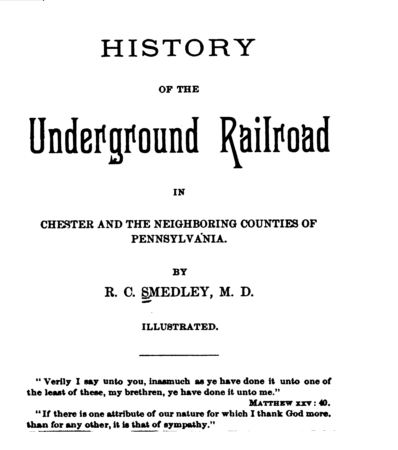
The name “Underground Railroad” was believed to have been first used in Columbia, Pennsylvania.  In his book The History of the Underground Railroad in Chester and the Neighboring Counties (1883), R.C. Smedley states the following:

In the early part of concerted management slaves were hunted and tracked as far as Columbia [Pennsylvania].  There the pursuers lost all traces of them.  The most scrutinizing inquiries, the most vigorous search, failed to educe any knowledge of them.  Their pursuers seemed to have reached an abyss, beyond which they could not see, the depths of which they could not fathom, and in their bewilderment and discomforture they declared there must be an underground railroad somewhere.  This gave origin to the term by which this secret passage from bondage to freedom was designated thereafter.

The Smedley book is a free download from Google Books.

Of course, other sources differ on the term’s origin – some claiming the origin occurred in the Kentucky-Ohio area and others giving the credit to Levi Coffin himself.  Nevertheless, Columbia’s claim to be the place where the term originated is enhanced by the history of the town as a major stopping place for freedom-seekers on their way north.  Columbia is also important to the residents of the Lykens Valley area as it is a town on the Susquhanna River south of Harrisburg and was the object of a Civil War incident, the burning of the Wrightsville-Columbia Bridge, which took place in June 1863, days before the Battle of Gettysburg.  Credited with saving the town of Wrightsville after the bridge was set on fire, was Confederate General John Brown Gordon (see post entitled Naked Man Visits Rebs on Rabidan).  Many believe if the bridge had not burned, the Confederate objective would have been the town of Columbia along the Susquehanna’s eastern bank, and with nothing to stop the rebel advance between Columbia and Harrisburg, the course of the war would have changed to a Union disaster.

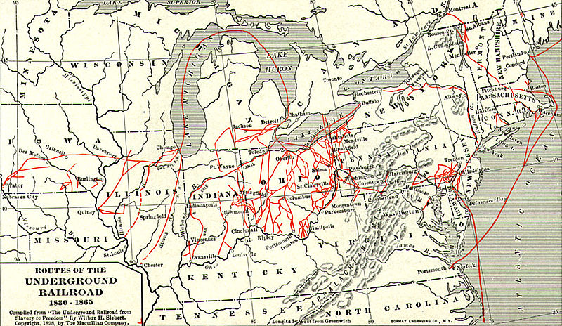
The Underground Railroad - A Map Published in 1898 (click to enlarge)

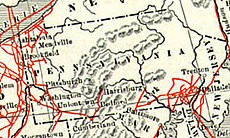
The above map shows some of the major routes that escapees used to go north.  But the map only tells part of the story as far as Pennsylvania is concerned.  The “cut” of the map shown below gives Harrisburg as a destination but does not show where the “railroad” continued north from Harrisburg.

To the right of the “g” in Harrisburg is a vertical line representing the Susquehanna River.  And, to the right of the Susquehanna River and slightly above the “g” in Harrisburg is a peanut-shaped mountain which is presumably Peter’s Mountain, the dividing line between upper and lower Dauphin County.  The presumption from this map is that the Underground Railroad ended in Harrisburg.  The red lines on the map that appear to go north and into New York or Canada are in western Pennsylvania.  Another concentration of lines appears in southeastern Pennsylvania around the city of Philadelphia with an escape route through New Jersey, near New York City, and into New York State.  This map provides no clues to the role of central Pennsylvania in the Underground Railroad – or the role of Harrisburg, other than a final destination.

No one knows for sure how many African-Americans escaped to freedom via the Underground Railroad.  Some Civil War estimates give numbers in the hundreds of thousands.  Canadian records could give some clue, but only by breaking down the total number of blacks into categories of native-born Canadians vs. those who emigrated there can some sense be made of the figures.  No one has yet done this with any degree of certainty.  Thus we are left with speculation.

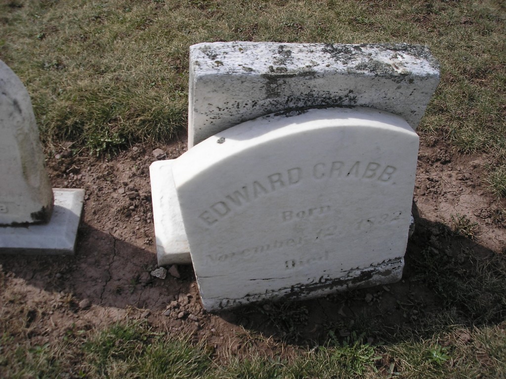
In addition to those who fled into Canada, many settled in welcoming communities along the way in the United States – Harrisburg included.  The Crabb family that arrived in Gratz in the early part of the 19th century is still of unknown origin.  Perhaps they were escapees from slavery and found in Gratz a welcoming community where they could practice their trade of blacksmith.  Sons of this early Lykens Valley area settler, Peter Crabb (1787-?) were born in Gratz and fought in the Civil War.  See post on African-American Civil War Monument.

Edward Crabb (1832-1886). Were his parents escapees from slavery via the Underground Railroad? Broken gravemarker in Gratz Union Cemetery.

Adding to the difficulties of the escapees were the notorious slave-catchers who were operating in both south and north under the auspices of the Fugitive Slave Act of 1850.Many escapees never made it to freedom.  Some were killed or died along the way.  Others were captured and were returned to slavery.

Tomorrow, the role of Harrisburg in the Underground Railroad will be discussed.

The portrait of Levi Coffin is from Wikipedia and is in the public domain because its copyright has expired.  The map of the Underground Railroad routes is also from Wikipedia.