;

Civil War Blog

A project of PA Historian

Camp Curtin Memorials

Posted By on February 17, 2012

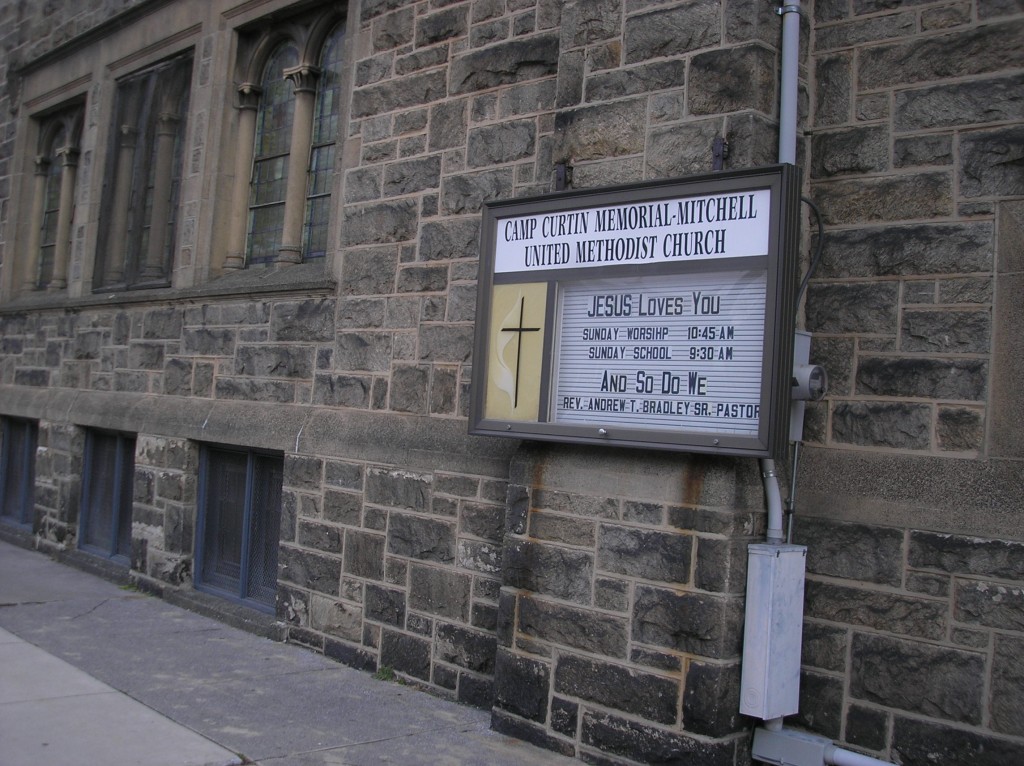
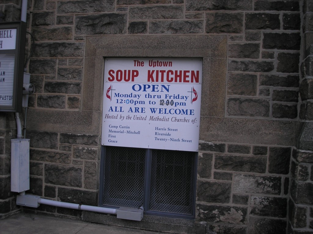
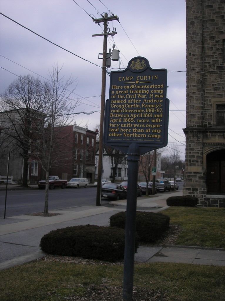
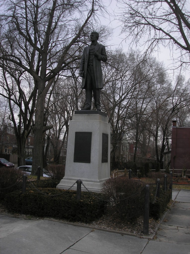
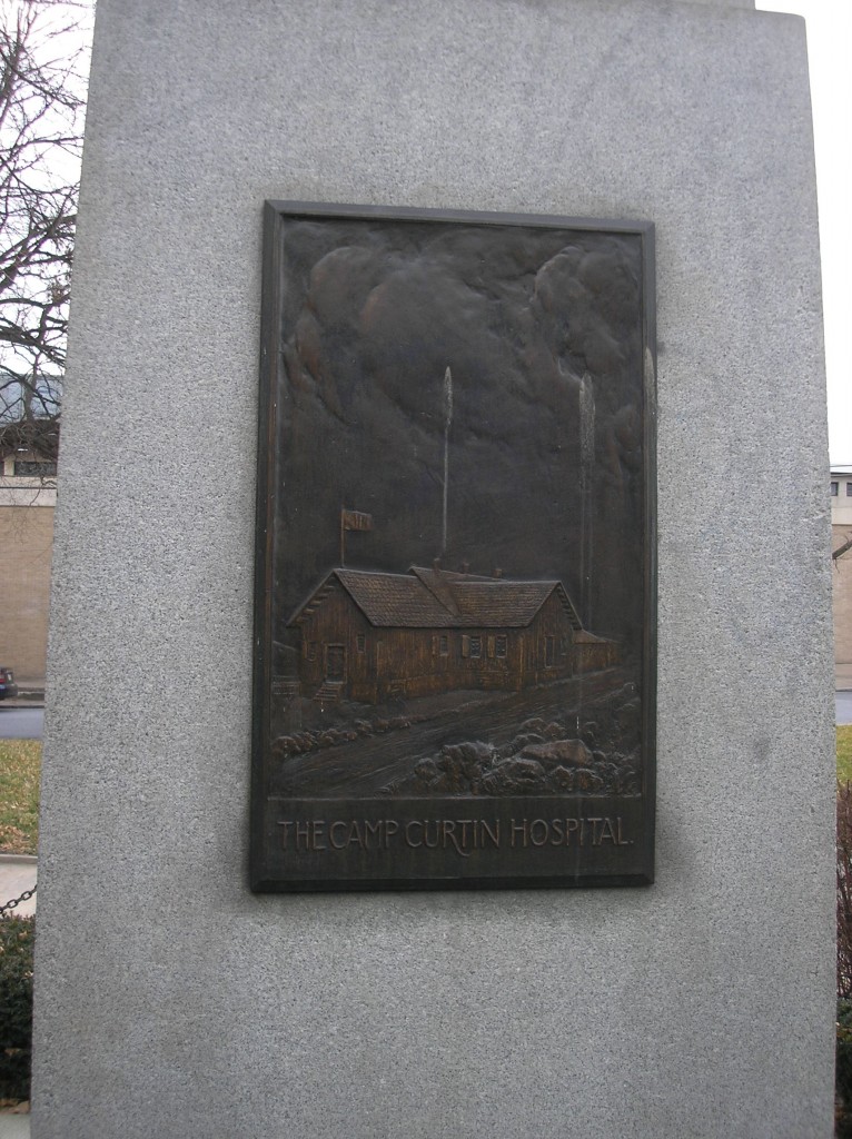
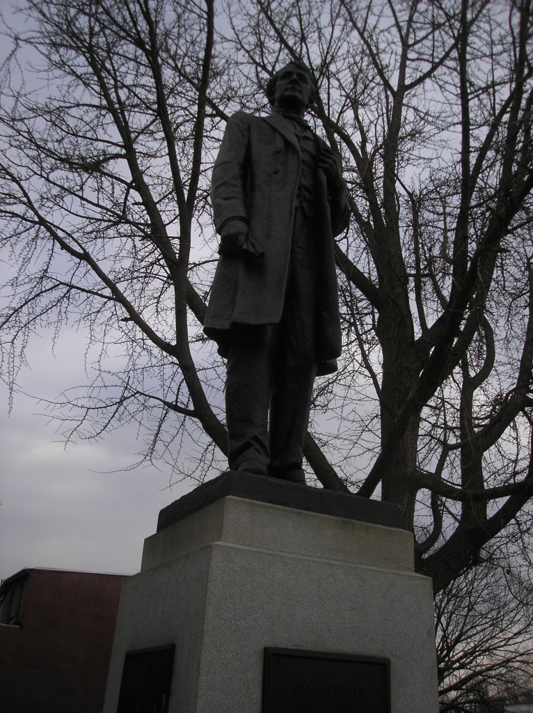
The four memorials to Camp Curtin can be found today in the city of Harrisburg, Dauphin County, Pennsylvania, on North 6th Street between Maclay Street and Woodbine Streets. The four memorials consist of (1) a marker placed by the Harrisburg History Project and found on the northwest corner of North 6th Street and Maclay Street; (2) the Camp Curtin Church which contains some memorabilia and artwork related to the camp, located on North 6th Street between  Woodbine and Forrest Streets, eastern side of the street; (3) the historical marker placed by the Pennsylvania Historical and Museum Commission, located just south of the church; and (4) the State Park containing a statue of Governor Curtin and four plaques picturing or describing what took place at Camp Curtin, located just south of the church and set back from the street.

——————————

Harrisburg History Project Marker

Camp Curtin

Harrisburg’s Civil War importance as a transportation center and state capital became strikingly clear upon the fall of Fort Sumter in Charleston Harbor, South Carolina, in April of 1861 when President Abraham Lincoln and Pennsylvania Governor Andrew Curtin issued a call for volunteers to take up arms against the Confederacy.  New recruits would converge on hastily established Union camps from which troops would be dispatched.  The largest of these camps throughout the entire course of the War, in both the North and the South, with over 300,000 enlistments passing through its gates, was Harrisburg’s Camp Curtin, located just north of Maclay Street between present-day N. 7th and N. 5th Streets.  The area which had been the grounds of the dauphin County Agricultural Society, were commandeered by Governor Curtin  for the establishment of the Camp, initially named Camp Union, that came to bear his name.  Regiments not just from Pennsylvania, but from Maryland, Michigan, Minnesota, New Jersey, New York, Ohio, and Wisconsin were mustered into service here.  The Camp held Confederate prisoners-of-war and its various wooden buildings included a hospital.  At the end of the War, the Camp became a major point for the discharge of the victorious Union troops.  Closed on November 11, 1865, the Camp was torn down and the land was eventually absorbed into the northward-moving urbanization of Harrisburg.  In recognizing the importance of Camp Curtin to the War effort the Commonwealth of Pennsylvania erected the present statue of Curtin in October 1922, on a plot of land that had been part of the Camp at N. 6th and Woodbine Streets and on what is the smallest State Park in Pennsylvania.  The neighboring Camp Curtin Memorial Mitchell United Methodist Church houses various Civil War artifacts and commemorative artwork.  Harrisburg was twice the military objective of Confederate Genral Robert E. Lee in the Northern invasions.  The first foray ended with the Battle of Antietam in Sharpsburg, Maryland, in September, 1862., the bloodiest day in U.S. history with 24,000 casualties.  The second Northern thrust became entangled at Gettysburg, two days before Confederate forces would have reached Harrisburg.  For three days, July 1-3, 1863, the most pivotal battle ever fought in North America existed, producing nearly 58,000 casualties and a repulse of the Confederate second invasion.  Camp Curtin’s presence in Harrisburg was one of the reasons this city was a military target.  The National Civil War Museum in Reservoir Park, largest museum in the world related to the American Civil War, opened in Harrisburg in 2001, and includes exhibits about Camp Curtin.

*

Period engraving of mustered troops being drilled at Camp Curtin.

*

View of Camp Curtin’s General Hospital, the only known photograph taken at the Camp.


——————————

Camp Curtin Memorial Mitchell United Methodist Church

——————————

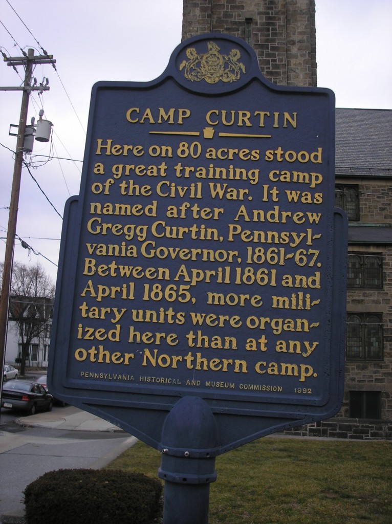
Pennsylvania Historical and Museum Commission Marker

CAMP CURTIN

Here on 80 acres stood a great training camp of the Civil War.  It was named after Andrew Gregg Curtin, Pennsylvania Governor, 1861-67.  Between April 1861 and April 1865 more military units were organized here than at any other Northern camp.

—————————-

Camp Curtin State Park

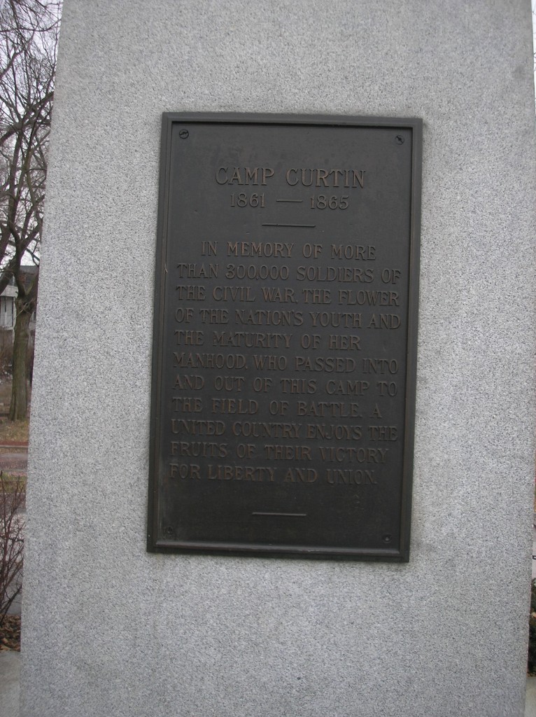
CAMP CURTIN

1861-1865

In memory of more than 300,000 soldiers of the Civil War.  The flower of the nation’s youth and the maturity of her manhood, who passed into and out of this Camp to the field of battle.  A united country enjoys the fruits of their voctory for liberty and union.

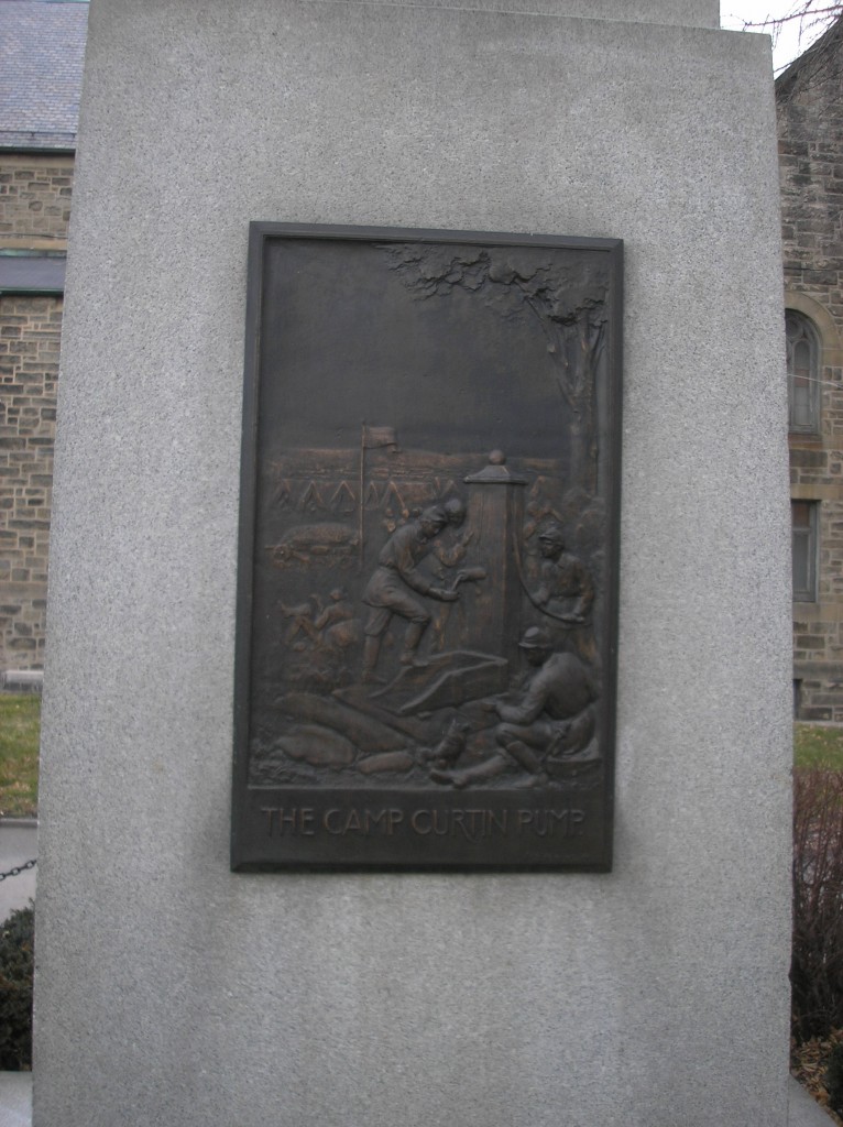
The Camp Curtin Pump

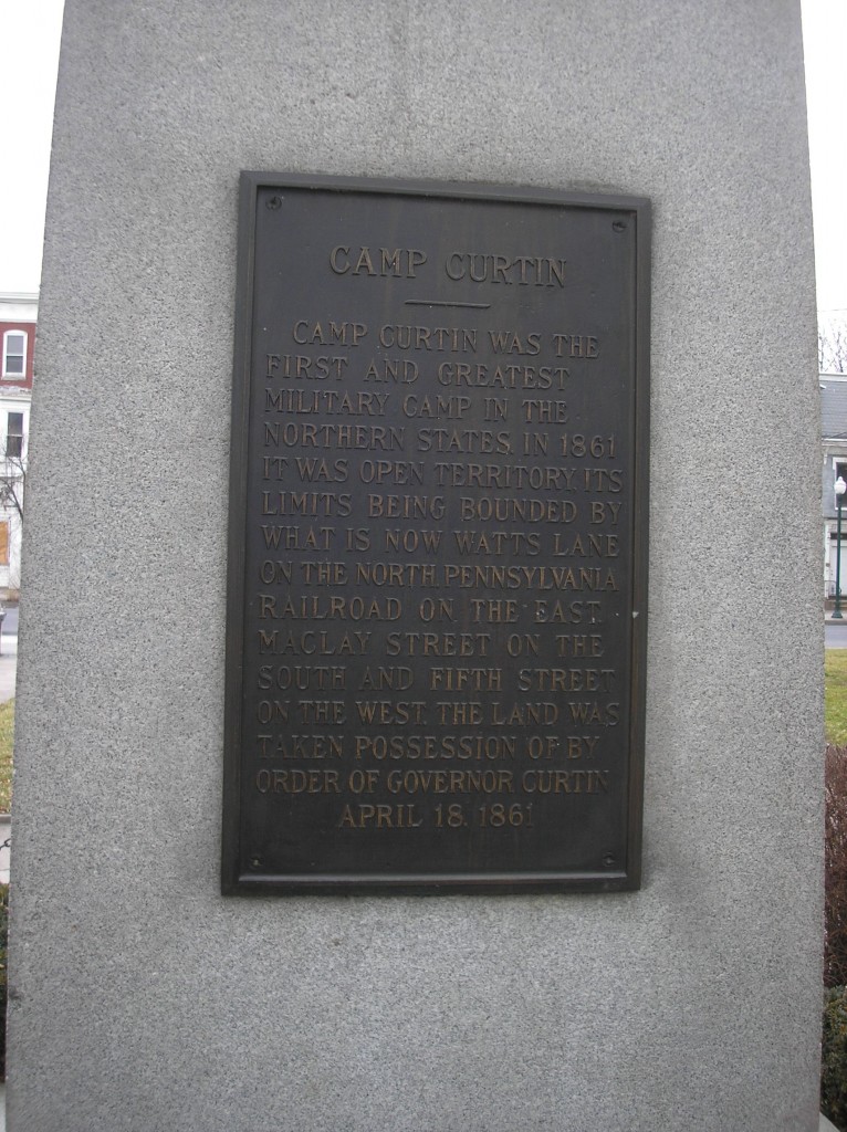
Camp Curtin

Camp Curtin was the first and greatest military camp in the Northern states in 1861.  It was open territory, its limits being bounded by what is now Watts Lane on the North, Pennsylvania Railroad on the East, Maclay Street on the South, and Fifth Street on the West.  The land was taken possession of by Governor Curtin, April 18, 1861.

The Camp Curtin Hospital

Statue of Governor Andrew Gregg Curtin


School Book Maps of the War in the East

Posted By on February 16, 2012

A study of the Civil War has always been an integral part of U.S. history courses offered in schools and colleges.  Maps of the physical area of conflict are usually included to supplement the text and to give some idea of as to the extent of the conflict – including the battles and skirmishes in the northern state of Pennsylvania.  Four history textbooks covering a period of time of over 100 years were examined to determine how Pennsylvanians were included in the study of the Civil War – and how maps were used to show the residents of the Lykens Valley area that they lived in a geographic area that was under direct attack by the Confederacy.  The first two books, also the earliest, were actually used in the Gratz schools and copies are in the collection of the Gratz Historical Society.

For each of the maps an analysis will be done to determine if Harrisburg was shown on the war map and if the strategic importance of Harrisburg and the area around it could be determined from the map, and how the text itself portrays Harrisburg’s strategic importance.

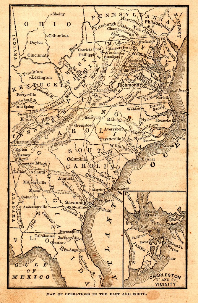
The first map is from a textbook published in 1878, A Smaller History of the United States from the Discovery of America to the Year 1872, by David B. Scott.  This book was in use in the Gratz public schools in the period after the Civil War and undoubtedly was read by the children and grandchildren of many of the veterans who served in the war.  The title of the map is “Map of Operations in the East and South.”  The size of the map is approximately 3.25″ x 5.25″ (click on any map to enlarge it).

The main feature of this map is that it shows the broad area in which the conflict took place.  Note that almost the entire states of Ohio, Pennsylvania and New Jersey are shown and in Pennsylvania, the cities of Harrisburg, Philadelphia, York, Gettysburg, Chambersburg, and Pittsburgh are named.  The Susquehanna River and its strategic location flowing into the Cheseapeake Bay is shown.  From this map, it is easy to show how “father” or “grandfather” who fought in the war, was defending the “homeland” of the Lykens Valley.

The text (Sections 63 & 64) notes the following:

63. Second Invasion of the North – Lee, then, for the second time, invaded the North.  Rushing rapidly down the Shenandoah Valley, he entered Pennsylvania and created great alarm.  The Union army, re-enforced, and now commanded by General Meade, followed, and took a strong position on the hills near Gettysburg, Pennsylvania.  Here Meade was attacked by Lee, July 1.

64. Gettysburg and the Results – The battle lasted three days, to the close of July 3.  Lee was everywhere repulsed, and on the 4th he recrossed the Potomac, and fell back to the south bank of the Rapidan.  The Union army followed to the north bank of the same river, but there was no further fighting between them during 1863.

The children of Gratz (and others who used this early text) also had the advantage of living personages who could relate stories of valor and courage in the defense of Pennsylvania.

——————————

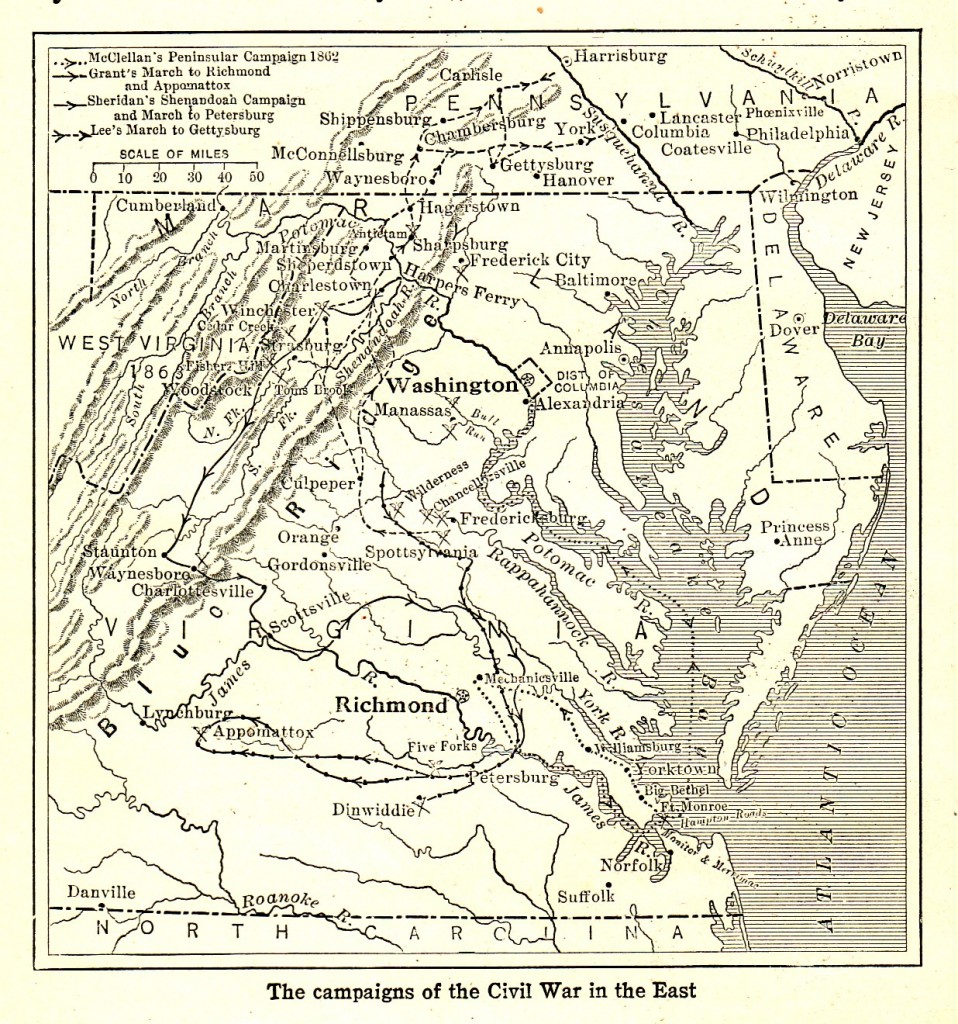
The second map is also from a textbook used in the Gratz schools.  Published in 1918, the School History of the United States was written by historian Albert Bushnell Hart.  The map entitled, “The Campaigns of the Civil War in the East,” was about 3.75″ x 4″ and in addition to cutting off just below the border of Virginia, the map also cut the state of Pennsylvania in half – and although Harrisburg just made it on the edge of the map, the school children of the Lykens Valley area had to locate Gratz above the map and not on it.  The map does indicate many Pennsylvania towns and cities and clearly shows the Susquehanna River (although only from Harrisburg south) and its flow into the Chesapeake Bay.

The text briefly told the tale of the Battle of Gettysburg:

In the East, after defeating the army of the Potomac at Chancellorsville, Lee made what proved to be the last attempt to penetrate the North by a southern army.  York and other towns in Pennsylvania were captured by the Confederates, and Baltimore, Philadelphia, and New York were alarmed.  General George E. Meade was put at the head of the Union army and threw it across the path of Lee at Gettysburg.  On the third day of terrible fighting, Lee made his last effort by ordering Pickett’s division of 15,000 men to charge on the Union lines (July 3).  The gallant effort failed: a few Confederates reached “the high tide of the Confederacy” on the ridge south of the town, but the attack was hurled back.  The next day, the Confederates retreated, and from that time to the end of the war Lee’s army was on the defensive.

Not as many veterans were alive in 1918 and later.  Their stories were not as easy to find by the generation of school children who more closely related to the Great World War than its distant “cousin” from the 1860s.

——————————

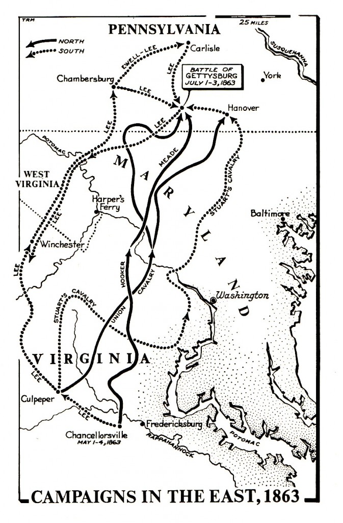
The next map is entitled “Campaigns in the East” and is from a college textbook published in 1962, The United States of America: A History, Volume I, by Dexter Perkins and Glyndon G. VanDeusen.  It is approximately 2.75″ x 4″.  Unfortunately, Harrisburg is not even on the map (as if there was no strategic value in its location) – and even worse, the Susquehanna River appears to begin south or near the location of Harrisburg instead of well north of Harrisburg where its origin is actually located.

The text states:

…On June 28, George Gordon Meade became commander of the army — just in time, for Lee had pushed 80,00 men up the Shenandoah Valley and into southern Pennsylvania on his last and greatest invasion of the North.

Lee took Chambersburg, Carlisle, and York, in Pennsylvania, and menaced Baltimore and Washington.  When Meade moved westward, north of the Potomac, threatening to cut the Confederate line of communication, Lee concentrated his army at Gettysburg.  The two armies met there July 1-3, 1863, in the biggest and bloodiest battle ever fought in the United States….

——————————

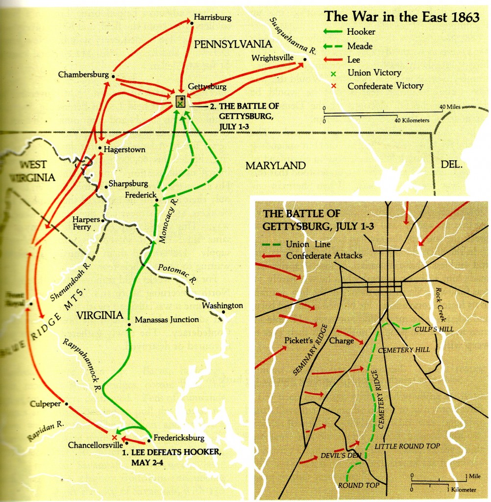
The last map is from a popular high school textbook published in the 1980s and co-authored by historian Daniel J. Boorstin (who also served as the 20th Librarian of Congress).  It was entitled A History of the United States.  The map of reference for the “War in the East 1863″ was in color and was about 6.25″ x 6.25” with a special inset for the Battle of Gettysburg.

One thing readily apparent from the map is that Harrisburg is on the wrong side of the Susquehanna River, although Harrisburg is noted as well as Lee’s movements in and around Harrisburg.  Students from the Lykens Valley area would have trouble finding the approximate location of Gratz and Millersburg because of the misplacement of Harrisburg.  And, by only showing the narrow confines of the 1863 movements of Lee into Pennsylvania, the greater strategy of the Confederacy is left in question by only reading the map.  The text does help clarify some of the objectives of the campaign.

President Davis and General Lee now decided to invade the North.  They still hoped that a decisive victory might demoralize the war party in the north, lead to the election peace Democrats in the fall elections, and bring foreign recognition of the Confederacy.

The Battle of Gettysburg.  With this large purpose in mind, Lee crossed the Potomac on June 11, 1863, leading an army of 70,000 men…. Units of the two armies stumbled into each other at the sleepy town of Gettysburg, Pennsylvania.  Both armies then hastened to the spot.  Here 165,000 men were to fight the greatest single battle ever to take place in the Western Hemisphere….

—————————–

A few final thoughts.  The first two maps clearly show the mountainous terrain, while the most recent ones do not.  None of the maps show the railroads, which were a major reason in the development of the strategies of the war.  None of the maps show the territory that was under the military control of each side.

Other maps will be presented at a later date.

This is the 73rd post in an ongoing series on the Battle of Gettysburg.

Pennsylvania’s Civil War Flags

Posted By on February 15, 2012

A good explanation of the design and use of battle flags used during the Civil War is found in Civil War Harrisburg, a book published by the Camp Curtin Historical Society and noted in a prior post on this blog.  Essentially, all state military regiments that were assigned to U.S. army units were required to carry national colors.   There were separate requirements for infantry regiment flags, artillery regiment flags, and cavalry regiment flags.  Although there were specifications for the size and design of these flags, they were not always followed by the state regiments – particularly if the state regiments were part of the state militia or emergency forces that were under the control of the governor.

Pictures of Pennsylvania’s Civil War regimental flags can be obtained from several on-line sources:

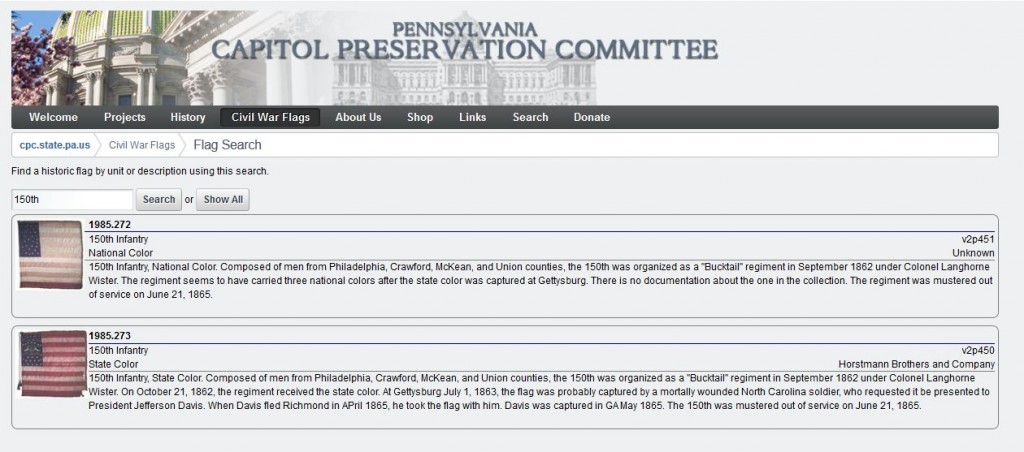
The primary source for these flags is the web site of the Capitol Preservation Committee which maintains Pennsylvania’s collection of Civil War flags.  The search page for these flags is easy to use but it is very helpful to know the numerical designation of the regiment to enter in the search box.

Click on picture to enlarge.

The search page, as shown above, is easy to use.  Simply type the regimental number in the box and click “Search.”  In the example below, “150th” is tpyed in the search box.

Click on picture to enlarge.

Two flags are shown in the result:  the national colors and the state colors.

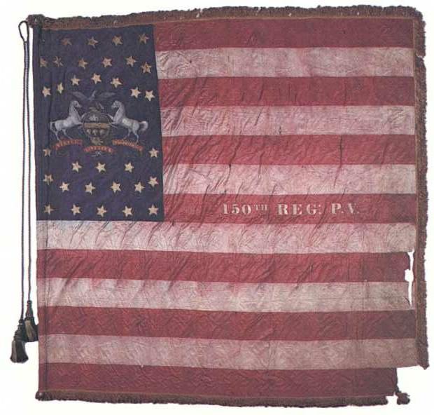
By clicking on the flag picture, it will open in a new window and it can be saved to disk (right click and save).

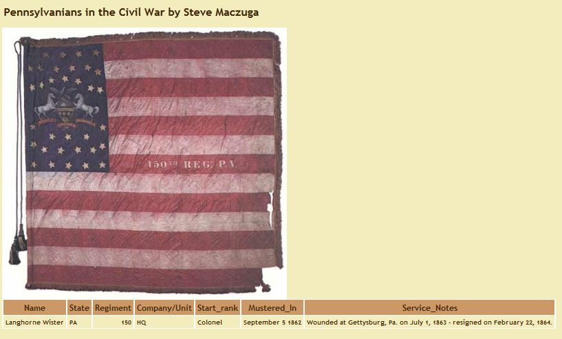
A secondary source on these Pennsylvania flags can be found at Steve Maczuga’s Pennsylvania Civil War Project/Pennsylvanians in the Civil War.  This source has been previously noted several times on this blog.  For the original post on Maczuga’s web site, click here  Since that original post of 4 January 2011, Maczuga has slightly modified the format to make the searching more user friendly.  Searching can now be done with a portion of a surname rather than requiring the complete surname.  The results are the same in that a “page” is shown with the flag and a brief description of the individual’s military service.  A search was done for “Wister” (Col.  Langhorne Wister) who served with the 150th Pennsylvania Infantry.  A list of all the persons with “wister” as part of their surname comes up and an opportunity is given to see the complete record.  One click and the following result is produced:

Click on picture to enlarge.

When only the soldier’s name is known, it is easier to use Maczuga’s site.  When the regimental numerical designation is known (and nothing else) it is easier to use the Capitol Preservation Committee site.  The resulting flag picture is the same, although the Capitol site gives the volume and page of the picture as a reference (from Dr. Richard Sauers, Advance the Colors, in two volumes) and a very brief history of the regiment.

The actual flags can be viewed at the Capitol in Harrisburg by calling for an appointment.  717-783-6484.

Finally, an on-line article (“The Colors of the Blue:  Union Battle Flags of the Civil War”) from The Bugle, the official journal of the Camp Curtin Historical Society is a free download.  Click here.  The article was published in fall 2009.


Gov. William Alexis Stone

Posted By on February 14, 2012

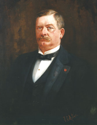
William Alexis Stone (1846-1920) served as Governor of Pennsylvania from 1899 to 1903.  He was born in Delmar, Tioga County, Pennsylvania, the son of Israel Stone (1802-1887) and Amanda [Howe] Stone (1806-1871).

When the Civil War started, William Stone was too young to join a regiment, and although he tried to enlist by falsifying his age, his father intervened and he had to withdraw.  William’s father, Israel Stone, needed him to work on the family farm in Tioga County, Pennsylvania.  When William became of age in 1864, he joined the 187th Pennsylvania Infantry, Company A, as a Private on 25 February 1864 and by 14 April 1864, he was promoted to 1st Sergeant.  By 10 March 1865, he received a promotion to 2nd Lieutenant, the position he held at discharge on 3 August 1865.  Several biographies report his service at the Battle of Cold Harbor and the Siege of Petersburg.

When the war was over, he studied law and soon after his appointment to the bar, he served for a time as a Clerk to the Pennsylvania Legislature.  In 1880, he was appointed U.S. District Attorney for the Western District of Pennsylvania and moved to Allegheny, County.  After re-appointment in 1884 by Republican President Chester A. Arthur, Stone chose to actively campaign for a fellow Civil War veteran, James A. Beaver, who was running for Governor of Pennsylvania.  This infuriated the newly elected Democrat, President Grover Cleveland, who removed Stone from office for violating the federal policy that prohibited federal office holders from participating in politics.  This did not dismay Stone, who then proceeded to run for the U.S. House of Representatives from the 23rd Pennsylvania Congressional District.  He was elected and served from 1891 though his resignation 1898 when he decided to challenge the incumbent Democrat Governor of Pennsylvania, George Jenks.  He won election easily, with the help of State Republican Political Boss Matthew Quay, another Civil War veteran with powerful influence in state G.A.R. activities.

William Stone was inaugurated as governor in 1899 and served only one term through 1903.  As a reward for Matthew Quay‘s support, Stone appointed him to a U.S. Senate vacancy that resulted from the legislature being unable to agree on a candidate.  The problem with this was that other than the obvious patronage connection, Quay was under indictment at the time for misappropriation of state funds – and he was also the incumbent – the state legislature was unwilling to return him to Washington because of the indictment.  The U.S. Senate did not approve seating Quay as the interim appointee so Quay used his influence to get the state party to nominate him making his election by the state legislature an eventual certainty as well as his acceptance by the U.S. Senate.  Ultimately, Quay was acquitted at trial of the misappropriation charges, but this left the state without one Senator for a two year period, and Quay served only from 1901 to 1904, dying in office.

During the time that Stone was Governor of Pennsylvania, he had to make a decision regarding the execution of Henry Rowe and Weston Keiper, who had been convicted of murder in the course of committing a robbery at the Halifax National Bank, Halifax, Dauphin County, in 1901. This case was discussed in several prior posts on this blog in that the victim, Charles W. Ryan, the bank cashier, was a Civil War veteran.

Attorneys for the condemned gave notice of filing reasons for a new trial.  The reasons were filed later and were overruled by Judge Simonton on May 18, when he sentenced the prisoners to be hanged by the neck until they are dead.  The case was taken to the higher court which met in Pittsburgh last October.  A new trial was refused after which Governor Stone fixed January 28, 1902, as the execution date of Rowe and Keiper.

The governor had the power to pardon the men, which he would not have done under any circumstances, or to commute their sentences to imprisonment for life.  Whether the killing of a Civil War veteran in the course of the robbery had any bearing on Stone’s decision to set the execution date without delay is not known.  However, the outrage among living members of the G.A.R. posts throughout the state must have had some effect on him.  Stone was a member of the G.A.R. and Union veterans had played a role in his political rise.  Little did Stone know at the time that as a result of the public spectacle created at the execution of Keiper and Rowe, reformers would be so outraged that the immediate result would be the banning by law of public executions in Pennsylvania and the establishment of a process of appeal that would insure that those convicted of capital crimes would have sufficient time for legal scrutiny and appeal – thus ending the hasty, public executions that took place in Pennsylvania.

For prior posts on the Halifax Bank Robbery, see:  Halifax Bank Robbery  Abraham Fortenbaugh; Halifax Bank Robbery – Isaac Lyter; Halifax Bank Robbery – Charles W. Ryan; and Halifax Bank Robbery – The Robbers.

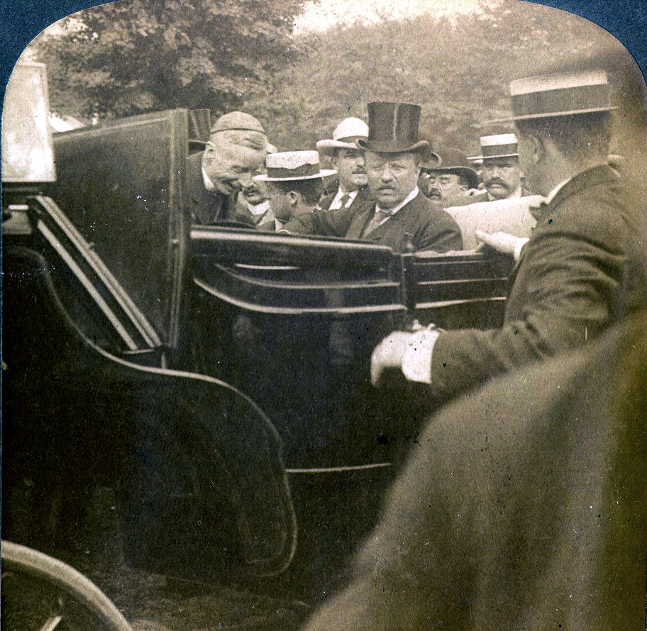
In 1902 Pennsylvania’s anthracite coal miners went on strike.  Governor William A. Stone’s supported the coal mine operators who were refusing to negotiate with the strikers.  This infuriated Pres. Theodore Roosevelt who saw the situation in terms of a nationwide coal shortage which would cripple the country’s industrial capacity.  Roosevelt set up an arbitration commission that resolved the situation in favor of the miners. The federal government, for the first time in American history, had favored workers over management in a labor dispute.

In the picture above, James Cardinal Gibbons (1834-1921) enters Pres. Roosevelt’s carriage in Wilkes-Barre.  Cardinal Gibbons was the Archbishop of Baltimore and took a lead in getting the Roman Catholic Church to change its resistance to the organization of labor unions:

It is the right of laboring classes to protect themselves, and the duty of the whole people to find a remedy against avarice, oppression, and corruption.

Cardinal Gibbons was responsible for urging the Pope to allow Catholics to join labor unions.  He quickly won the trust of labor for his humanitarian concerns and he advocated a non-violent approach to dispute resolution.  He was widely respected by government leaders.  President Theodore Roosevelt said of him that he was the most venerated, respected, and useful citizen in America.

Gibbons was ordained a priest at the start of the Civil War and served as Chaplain at Fort McHenry during the war.  After the war, he served in ministry in  North Carolina and at age 34, he was consecrated a bishop, making him one of the youngest in the world.  In 1887, Gibbons became Cardinal.  In addition to serving in North Carolina and Richmond, he advocated for the creation of The Catholic University of America, and in 1887, with its creation, became its first Chancellor.  He was also the author of several books which explain the teachings of the Roman Catholic faith.

During the coal strike of 1902, James Cardinal Gibbons was serving as Archbishop of Baltimore.  Gov. Stone had to deal directly with him during the strike.

Gov. William A. Stone was succeeded in office by Samuel A. Pennypacker, also a Republican and also a Civil War veteran.

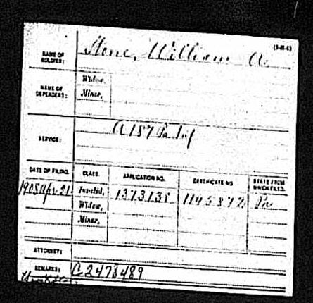
After he left office, William Stone applied for a Civil War pension and received one.  It is not known why he chose to wait so long to apply as he would have been eligible much earlier.  He died in 1914 and is buried in Union Cemetery, Bellefonte, Centre Co., Pennsylvania.

In retrospect, Stone must be given credit for eliminating a $3,000,000 state debt during his time as governor and for the commissioning of architect Joseph H. Huston to design a new capitol building to replace the one that had been destroyed by fire in 1897.  The new building was completed during the term of Stone’s successor, Samuel Pennypacker.

Some information for this post was taken from biographical sketches of Stone that appear on the web site of the Capitol Preservation Committee, Wikipedia, and Find-a-Grave.  The portrait at the head of this post is from the Capitol Preservation Committee.  The Veterans’ Index Card is from the Pennsylvania Archives.  The Pension Index Card is from Ancestry.com.

Matthew S. Quay (1833-1904) was awarded the Medal of Honor for gallantry at Fredericksburg, 13 December 1862.  A stone with his name is located in the Pennsylvania Medal of Honor Memorial and was featured in a prior post.  Quay was born in York County.  He will be featured in a future post on this blog.

James A. Beaver (1837-1914) served as an officer in the Civil War and eventually achieved the rank of Brevet Brigadier General.  He lost a leg  during the war and in addition to serving as Governor of Pennsylvania, he was very active in state G.A.R. affairs.  Military portraits as well as further biographical information about him will be present in a post one week from today.


Popular Songs of the Civil War Era

Posted By on February 13, 2012

Popular Music during the Civil War took several forms: hymns,marching songs, and songs that told stories about events of the war were all popular.

A short film from 1963 featuring several civil war era songs, featuring U.S. Army Band and Chorus:


If you have trouble viewing the above browser, go here.

Old Black Joe

first verse:

Gone are the days when my heart was young and gay,
Gone are my friends from the cotton fields away,
Gone from the earth to a better land I know,
I hear their gentle voices calling “Old Black Joe”.
Chorus
I’m coming, I’m coming, for my head is bending low:
I hear those gentle voices calling, “Old Black Joe”.

Complete lyrics and audio files can be found here: http://www.stephen-foster-songs.de/foster022.htm

When the Corn is Waving, Annie Dear


(more…)