Gratz During the Civil War
Posted By Norman Gasbarro on June 18, 2011
Today we begin a series of posts to try to determine what Gratz looked like during the Civil War, 1861-1865. One of the purposes of this series will be to determine what buildings remain from the period.
We begin with some of the available maps.
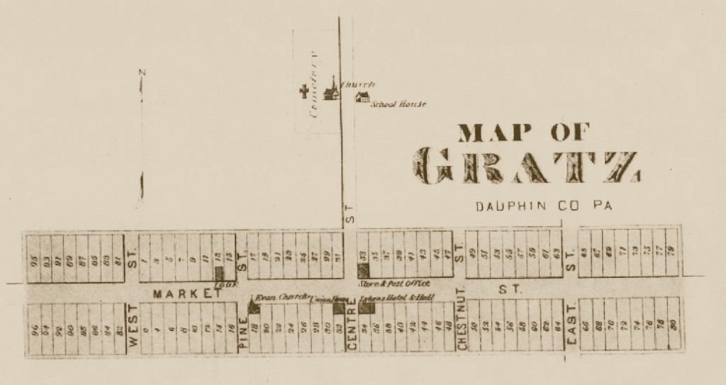
The first map is of the “Lot Plan” of Simon Gratz which was recorded in Dauphin County deeds of 1829. It is used to show the original Simon Gratz lot numbers. The map was reproduced in A Comprehensive History of the Town of Gratz, page 77. These original lot numbers are referenced to property histories that are found in the book. The orientation of the map is north at the top and south at the bottom.
According to A Comprehensive History of the Town of Gratz Pennsylvania:
Simon Gratz laid out a town, called and forever hereafter to be called the town of Gratz. A draft was made consisting of ninety-six lots, and numbered one to ninety-six inclusive… with the following streets and alleys and of the widths as represented by the above plan viz… Market Square one hundred feet wide, Market Street to be eight feet, East Street and West Street each sixty feet, centre Street fifty feet, Pine and Chestnut Street each forty feet, and East, West, North and South Alley each twenty feet. Each of the ninety-six lots containing in breadth fifty feet. Those fronting Market Square 190 feet in length and those fronting Market Street being in length 200.
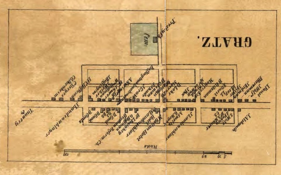
The second map is of Dauphin County in 1858 and was originally published by William J. Barker of Philadelphia. The “inset” map of Gratz is shown below. Names of property owners are indicated. Note that the orientation of this map is south at the top and north at the bottom; therefore the map is intentionally shown upside down so that its orientation matches the other maps. Unfortunately, the map the Pennsylvania Archives has provided on its web site is split and a portion of Gratz is found in two different sections. For the purpose of this post, the two sections were joined and some of the names in the seam may not be readable.
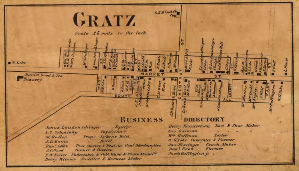
The third map is from 1862 and is by A. Pomeroy, Publisher, of Minor Street, Philadelphia. The orientation is north at top and south at bottom. This is the only known map of Gratz from the Civil War years.
The final map is of unknown origin and is probably from the mid-1870s. Its orientation is north at top and south at bottom and it contains the original Simon Gratz lot numbers.
In addition to the maps, there is also census information from 1860 as well as other resources from the book A Comprehensive History of the Town of Gratz Pennsylvania – including a list of property owners from 1865, taken from Dauphin County tax records and keyed with the original lot numbers. The book contains detailed information on each property in Gratz listing all property owners and genealogies of every family that lived on the property. There are pictures of the buildings from various eras and the people who lived in those building. Most important for this series of posts, the book will be used to determine what buildings or portions of building still exist from the Civil War years.
Finally, a word about the original lot numbers and the current street addresses in Gratz. Lot numbers were only used on deeds and were never used as street addresses. Mail sent to Gratz was sent to the Post Office and picked up by addressees and Gratz was small enough that the postmaster knew everyone. When street addresses were finally assigned and home delivery became common in rural areas, the numbering system was designed so that houses on the west side of Center Street had “West Market Street” addresses and on the east side, had “East Market Street” addresses. During the Civil War, there was no home mail delivery. Today, many residents choose to have post office boxes in the Gratz Post Office and do not use their street addresses.
Tomorrow, Lot #11 will be examined in part 2 of this series. Additional properties will be presented during the months ahead.
The 1858 map and the 1862 map are from the Pennsylvania Archives: 1858. 1862.
 ;
;


Comments