Election of 1860 and the Lykens Valley
Posted By Norman Gasbarro on December 20, 2010
The election of 1860 was held throughout the United States on 6 November 1860. The result was that Abraham Lincoln won a majority of the electoral votes and thus was elected President of the United States. His election supposedly was the trigger that brought about the secession crisis. South Carolina voted to secede from the Union on 20 December 1860.
The Harrisburg Patriot first reported the popular vote totals in its 20 December 1860 edition. That reporting emphasized that Lincoln had not won the total popular vote, but the vote had been largely sectional, and that there were more votes against Lincoln than for him. By states, the results showed that in ten states – those that would later join the Confederacy – Lincoln did not receive one popular vote. But the reporting was by state totals only and did not reflect the diverse groups that made up each state nor did it indicate the vote totals within the political divisions of the states.
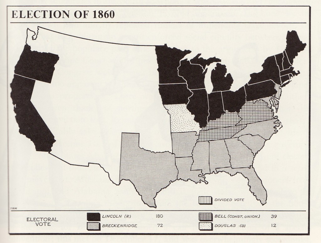
Traditionally, history has been taught in a simplified way – most often with generalizations that were assumed to be unquestionable facts. With elections, it was very easy to present a map showing how each state voted – with colors used to represent the winning party vote . In the age of “black and white” textbooks, the election map of 1860, the “black” represented the Republicans and the “white – with some black (checks, dots, etc.)” represented the opposition to the Republicans – Stephen A. Douglas (Northern Democratic), John Bell (Constitutional Union) and John C.Breckinridge (Southern Democratic).
The above map, from a college history textbook used in the 1960s, shows Pennsylvania’s electoral votes went for Lincoln and the Republicans – and the sectional divide was very clear – the North voted for Lincoln overwhelmingly, the deep South voted for Breckinridge overwhelmingly, and the states in between were divided. That’s obvious. But were there voting patterns within each state? Is it possible, from existing information, to determine how people voted within a county – or a community within a county? Is it possible to determine how the people of the Lykens Valley area voted? Is it possible to break down the vote by ethnic groups? How did the descendants of German immigrants vote? of Irish immigrants? of English immigrants?
First, it is important to understand that in 1860, there was not universal suffrage. Women did not have the vote in Pennsylvania until the 20th century. As early as the 1830s, there was some question as to whether free Blacks could vote in Pennsylvania, but this was a more important issue in cities such as Philadelphia than in rural area, where the percentage of free Blacks was so small that the vote would not have made a difference in the outcome. By 1860, the issue had not been decided on any uniform basis throughout Pennsylvania. Recent immigrants and immigrants not deemed citizens would not have voted. So, with limited suffrage a fact, if any determination could be made as to how the Lykens Valley area voted, would that determination have any meaning as to the feeling of the populace as a whole?
A second issue involves geography. How convenient was polling to the people of the Lykens Valley? How far did they have to travel to cast their ballots? In 1860, the area was essentially rural and agricultural, with many scattered towns and villages. The transportation network was crude by today’s standards. Only one rail line existed in the valley. Would people have traveled a great distance to vote?
An additional problem occurs with the question of political divisions. “The Lykens Valley” is not a political division. When this Civil War Project was first undertaken, a triangular area was defined that included territory in three Pennsylvania counties – Dauphin, Northumberland and Schuylkill. If election statistics are found for Pennsylvania counties, is it possible to break down the numbers in such a way as to estimate the total popular votes received by each of the four candidates in the area defined as the Lykens Valley triangle?
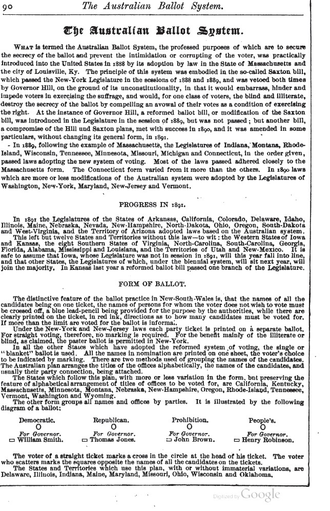
Finally, secret ballots, were not in full use in the United States until the presidential election of 1892. This meant that in 1860 voting took place in the open, in meeting formats, where the ballot was cast by the individual calling out the name of the candidate for whom he wished to support. According to an article that appeared in the 1892 World Almanac, the first state to introduce the secret ballot was Massachusetts in 1888. The degree to which intimidation and corruption took place in the Lykens Valley in the voting of 1860, two reasons for the reform of the system, is not known.
Any study of the votes cast in 1860 from the Lykens Valley must take into account the above factors. Nevertheless, conclusions still can be drawn from any raw data obtained. Within a few months from the election of 1860, Lincoln would be inaugurated, the Civil War would begin, and the first men would be called into service. How did the people of the Lykens Valley view Lincoln and how widespread was their support for him?
Research continues into this topic. Contributions and ideas are welcome.
News article on popular vote by state from Harrisburg Patriot, 20 December 1860, on-line resources at Free Library of Philadelphia. Election map of 1860 from Dexter Perkins & Glyndon G. VanDeusen, The United States of America: A History, Macmillan Company, 1862, Vol. I, p. 633, used for the purpose of review. Information on Australian Ballot System from 1892 World Almanac, Google Books (free download).
 ;
;


Comments