 ;
;
The Shamokin Soldiers’ Circle – Mapping the Circle
Posted By Norman Gasbarro on February 22, 2014
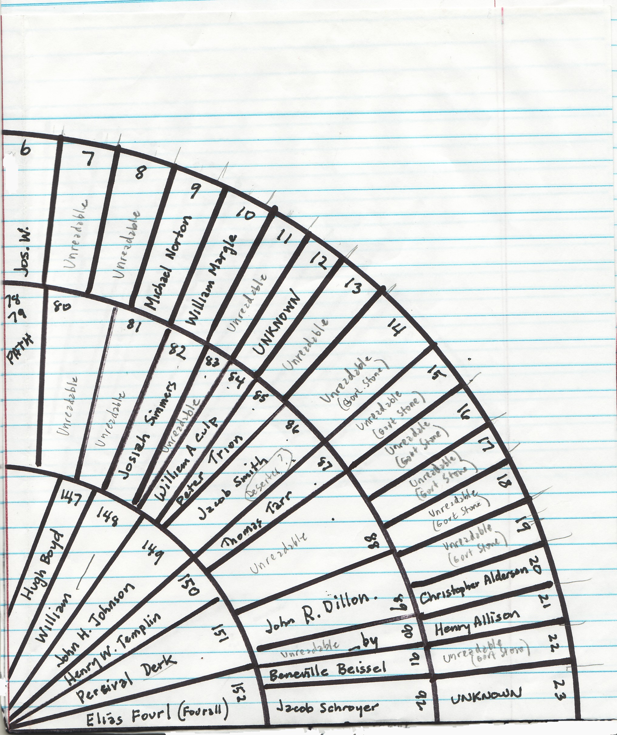
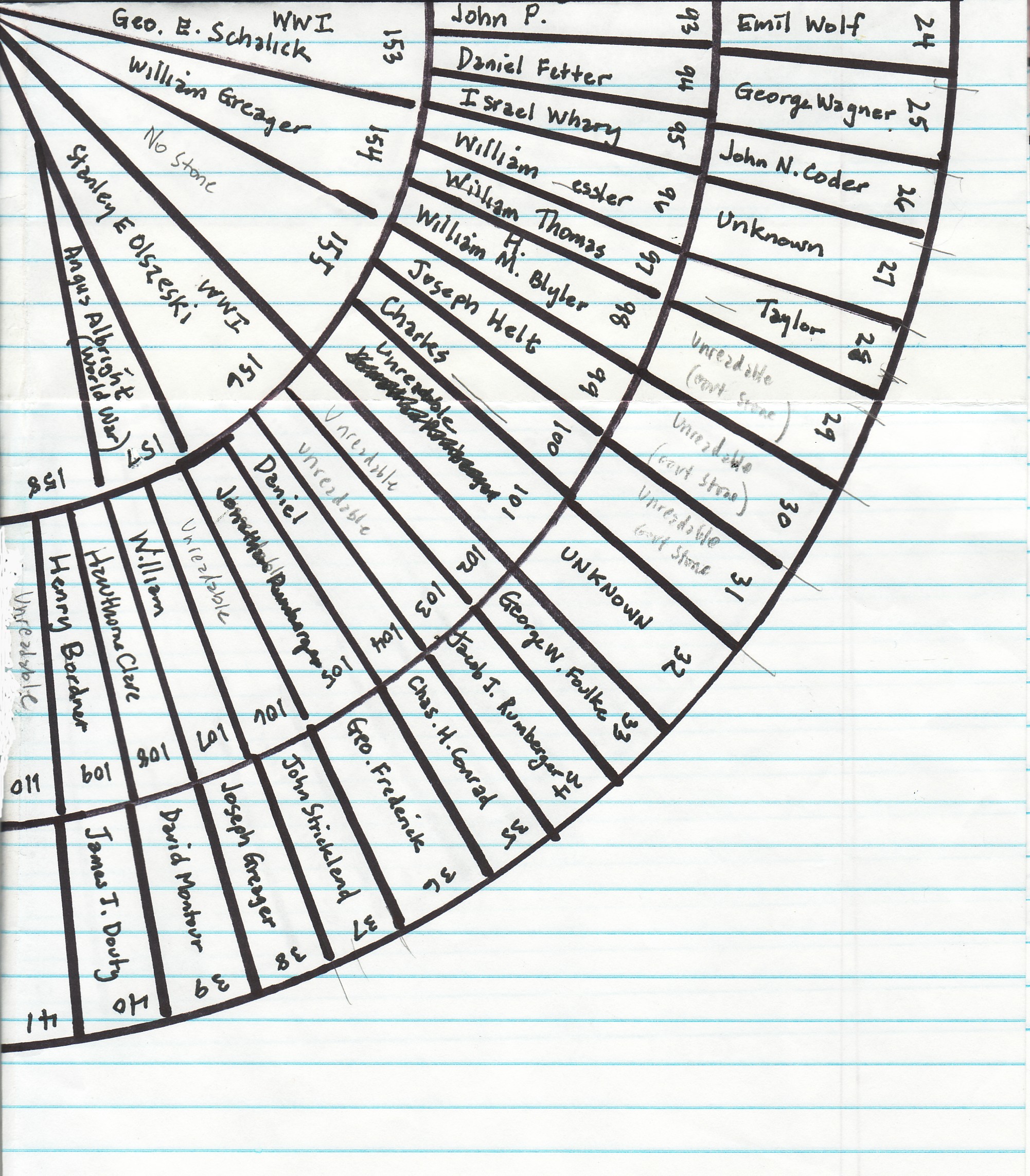
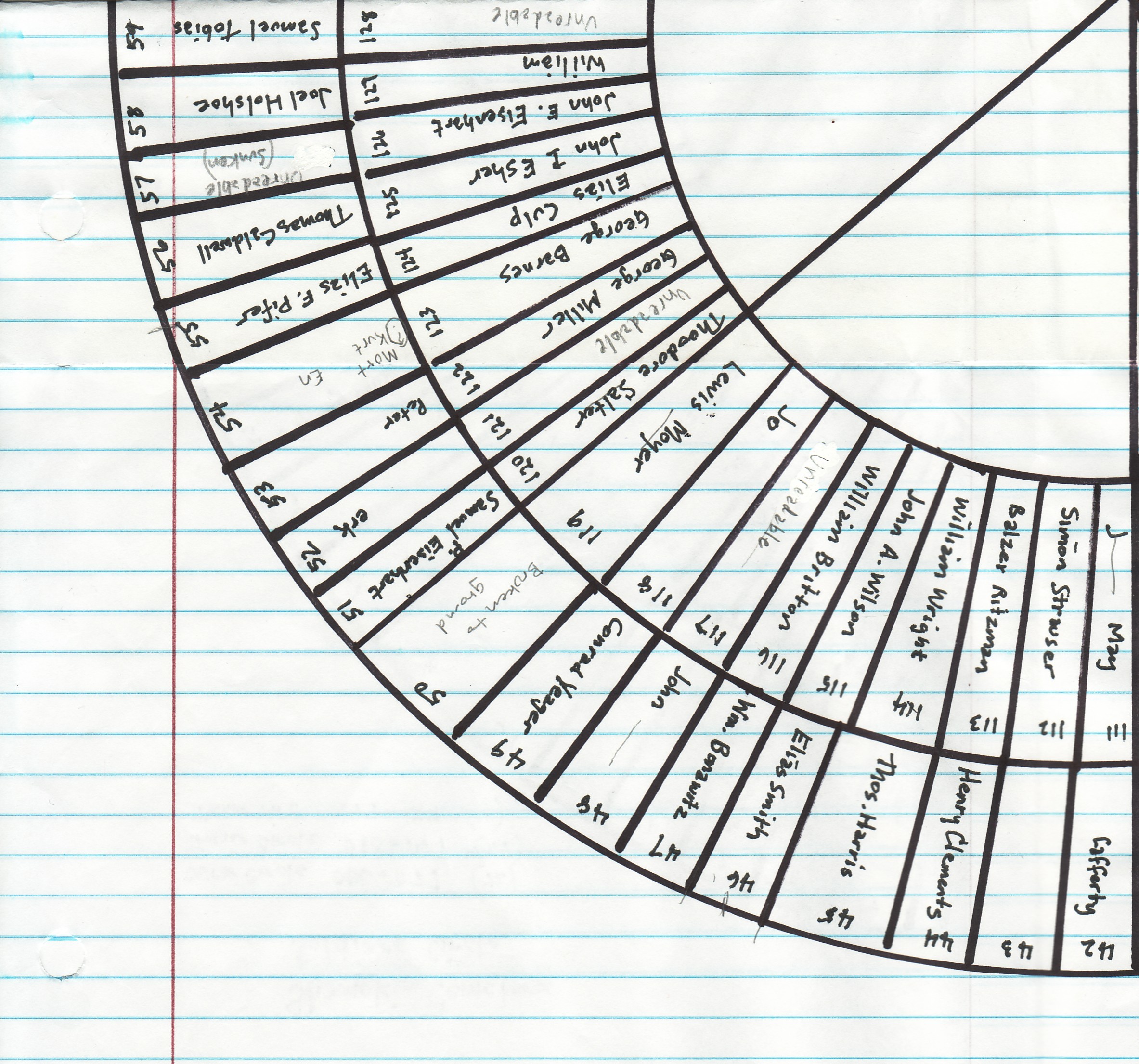
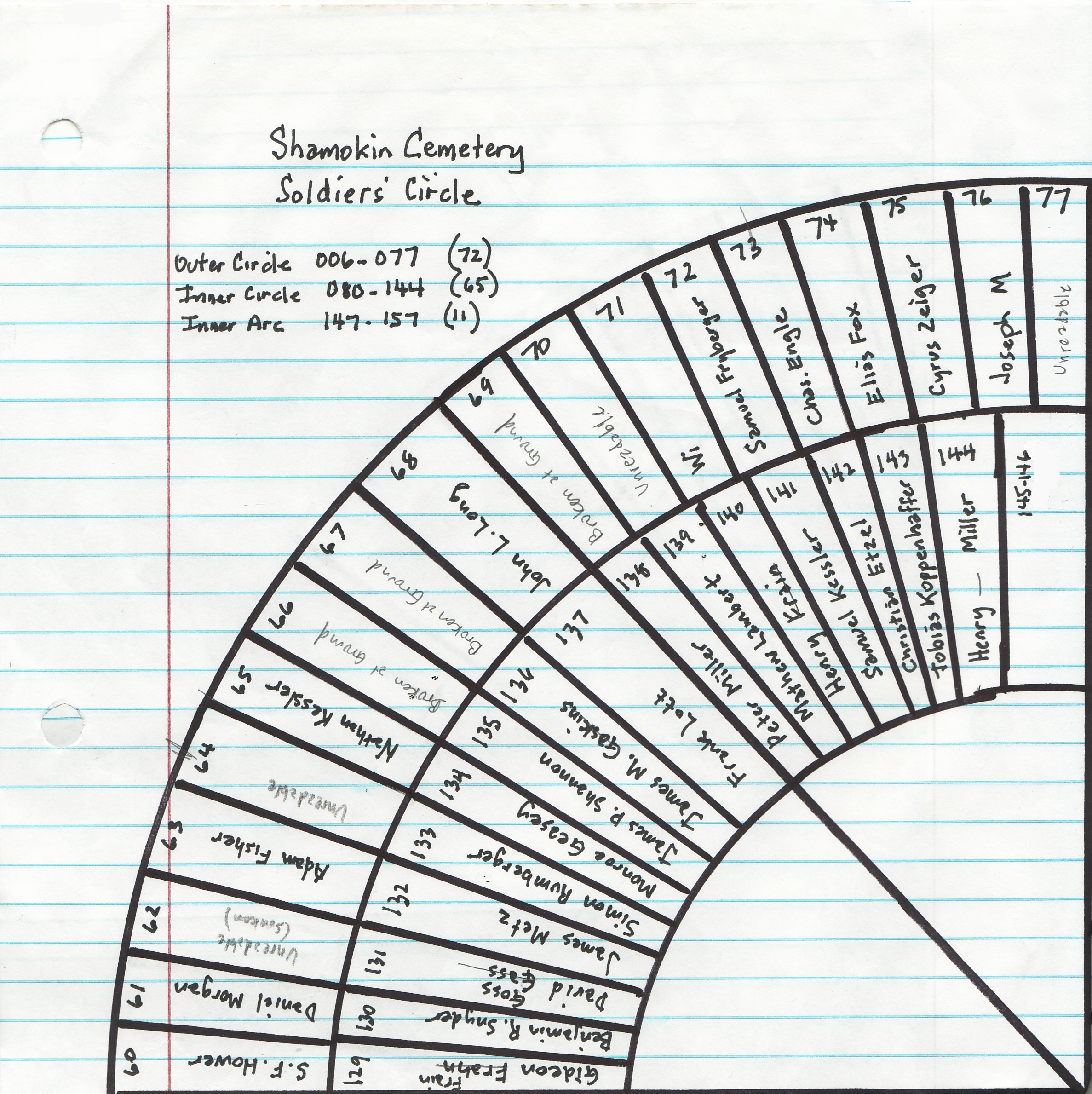
The G.A.R. Soldiers’ Circle at the Shamokin Cemetery, Shamokin, Northumberland County, Pennsylvania, was described and pictured in the previous blog post in this series. In today’s post, the map will be pictured which was drawn from the sequential series of photographs taken at the Circle in 2012 by the Civil War Research Project. The maps is presented in four quadrants. It is not drawn to scale and the numbers on the map represent the numbers of the photographic images that were taken – not the “official” grave-site location designations for the cemetery. The best interpretation of the name on the grave stone is given on the map quadrant. In later posts, research on each of the veterans buried in the Soldiers’ Circle will be presented.
The sequential photographs were taken beginning with the central monument which was featured here in a post on 27 October 2012. Photographs of the central monument were numbered 1 through 5. Then, beginning at the path into the circle, the outer circle graves were photographed and they are numbered 6 through 77. The path photographs are numbered 78 and 79 and the graves of the second circle begin with photograph number 80 and continue through number 144. The path photographs for the third or innermost circle are numbered 145 and 146. The third, or innermost circle, begins with photograph 147 and ends with photograph number 157. This third circle is not complete and does contain some graves from veterans of wars after the Civil War.
In each of the quadrants there are “unidentified” graves. Some have unreadable stones. Some have no stones, broken stones, or sunken stones. The worst section is the first quadrant which has some of the oldest graves and stones which have the worst weathering. If anyone reading these post can identify who is buried in those graves, the information would be greatly appreciated. Comments can be added to this post or to any of the posts in this series or can be sent by e-mail to the Project.
When standing in the center of the circle, the path is identified as being at 12 o’clock. The first quadrant pictured is from 12 o’clock to 3 o’clock:
Click on map to enlarge.
The second quadrant pictured is from 3 o’clock to 6 o’clock:
Click on map to enlarge.
The third quadrant pictured is from 6 o’clock to 9 o’clock:
Click on map to enlarge.
The fourth quadrant pictured is from 9 o’clock to 12 o’clock:
Click on map to enlarge.
At this time, the individual names on the stones will not be presented in the text of the blog post. The names, as identified on the map, will be presented in future posts as the photographs are presented. All of the photographs will be presented, whether or not there are readable stones.
The next post in this series will feature the graves of veterans in photographs 6 through 14.
——————————
For all posts in this series, click on ShamokinSoldCircle.
MapSoldCircle.


Comments