 ;
;
Civil War Railroad Structures of Elizabethville
Posted By Norman Gasbarro on April 4, 2016
Previously on this blog, a brief discussion of the Elizabethville Railroad Station (Lykens Valley Railroad) mentioned the following:
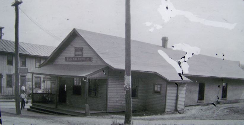
The railroad station at Elizabethville, Dauphin County, Pennsylvania, which was built about 1872, still stands today and is one of the oldest stations still in existence in central Pennsylvania. The tracks, which once ran through this borough, were torn up in the 1970s, and a street and parking lot exists where once there was a roadbed. Some early pictures are available of the 1872 station but are mostly from the turn of the twentieth century. Unfortunately, no pictures have yet been found of the first office, a log building which opened on the north side of the tracks in 1845 and served the community until the first actual station was built in 1858 at 37 South Market Street, also on the north side of the tracks. The 1872 station was built on the south side of the tracks.
Currently, the third building which was built seven years after the Civil War, is in disrepair and does not appear to be used for any active business.
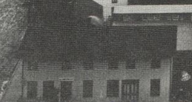
The second station, built in 1858, and which served Elizabethville during the Civil War, was demolished some time in the 20th Century. It was built on the north side of the tracks. That second station has been located in a 1911 panoramic photograph of Elizabethville which appeared in the 1967 souvenir book for Elizabethville’s Sesquitennial.
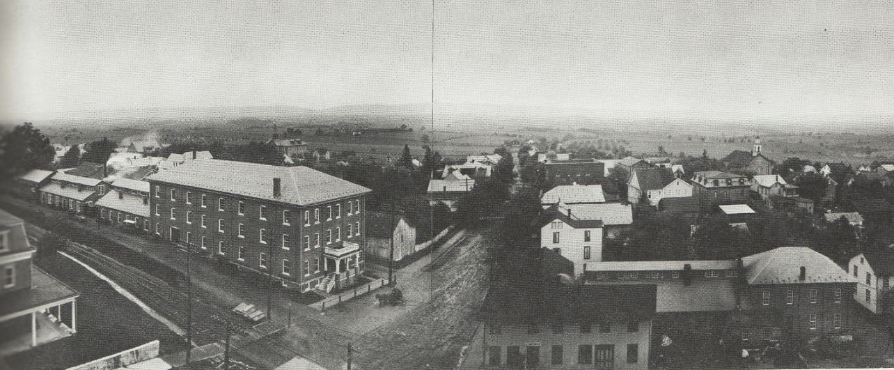
The railroad station is identified as the building at the lower center of the picture. In enlargement, it is shown below:
Since the panoramic picture is from 1911, the second station built in 1858 (shown above on the North side of the tracks) and the third station (on the South side of the tracks) built in 1872, co-existed for many years. However, during the Civil War years, 1861-1865, Elizabethville‘s only railroad station was the one pictured above.
The panoramic view does show the configuration of the tracks running west to Millersburg, past the Swab Wagon Company buildings (the 3-story brick building and factory buildings behind it). From the 1911 photograph, the two tracks that service the two station buildings merge back into one track alongside the Swab factory.
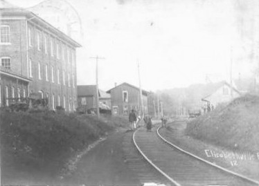
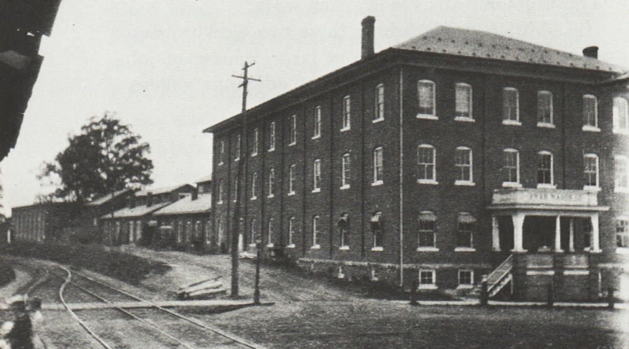
Looking East from the single track line alongside the Swab factory, the above picture-post-card photo shows both the Civil War station (the two story building at the center) and the 1872 station (at the right). The brick 3-story Swab building was built in the 20th Century.
The Civil War station can be seen at left in the above rare photo from the files of the Interstate Commerce Commission, Washington, D.C., probably taken at about the time of World War I.
It is likely that the 1906 photo (above) was taken from the front of the 1872 station. However, the two tracks that went past the 1858 station were possibly there at the time of the Civil War as trains needed “passing” sidings en route on single track lines. Track switches were of the stub type until after the Civil War when many were replaced with the more modern type of switches. From a prior blog post:
“Old Style Switches” were of the “stub” type rather than of the modern “point type”. In the “old style” , the ends of the rails were aligned to move trains from one track to another. Modern switches, which came into use after the Civil War, moved a taper-ended rail against the inside of a solid rail to divert the train to a different track. Stub connections are still used today at ferries and in turntables/roundhouses.
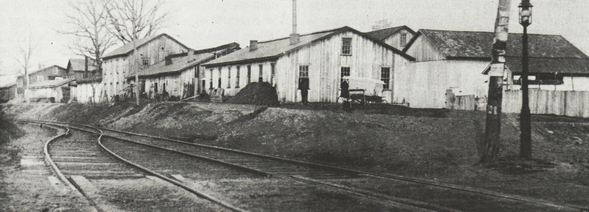
An earlier view of the Swab Wagon Company (above), taken from about the same location but prior to the construction of the 3-story brick building, shows the factory as it appeared in the 1880s and 1890s. The photograph was probably taken a few feet west of the 1858 and 1872 stations.
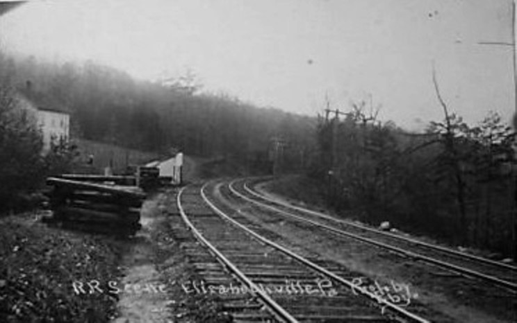
The above 2-track photo may be from East of the railroad stations. The small structures along the tracks are not identified and it is not known if they were there during the Civil War.
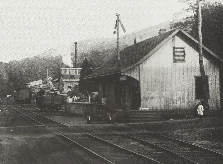
A 1900 photo of the 1872 station shows a planing mill in the background, and while hardly noticeable, part of a section of track in front of the 1858 station (at left), indicating that at one time a siding may have ended in front of the Civil War station.
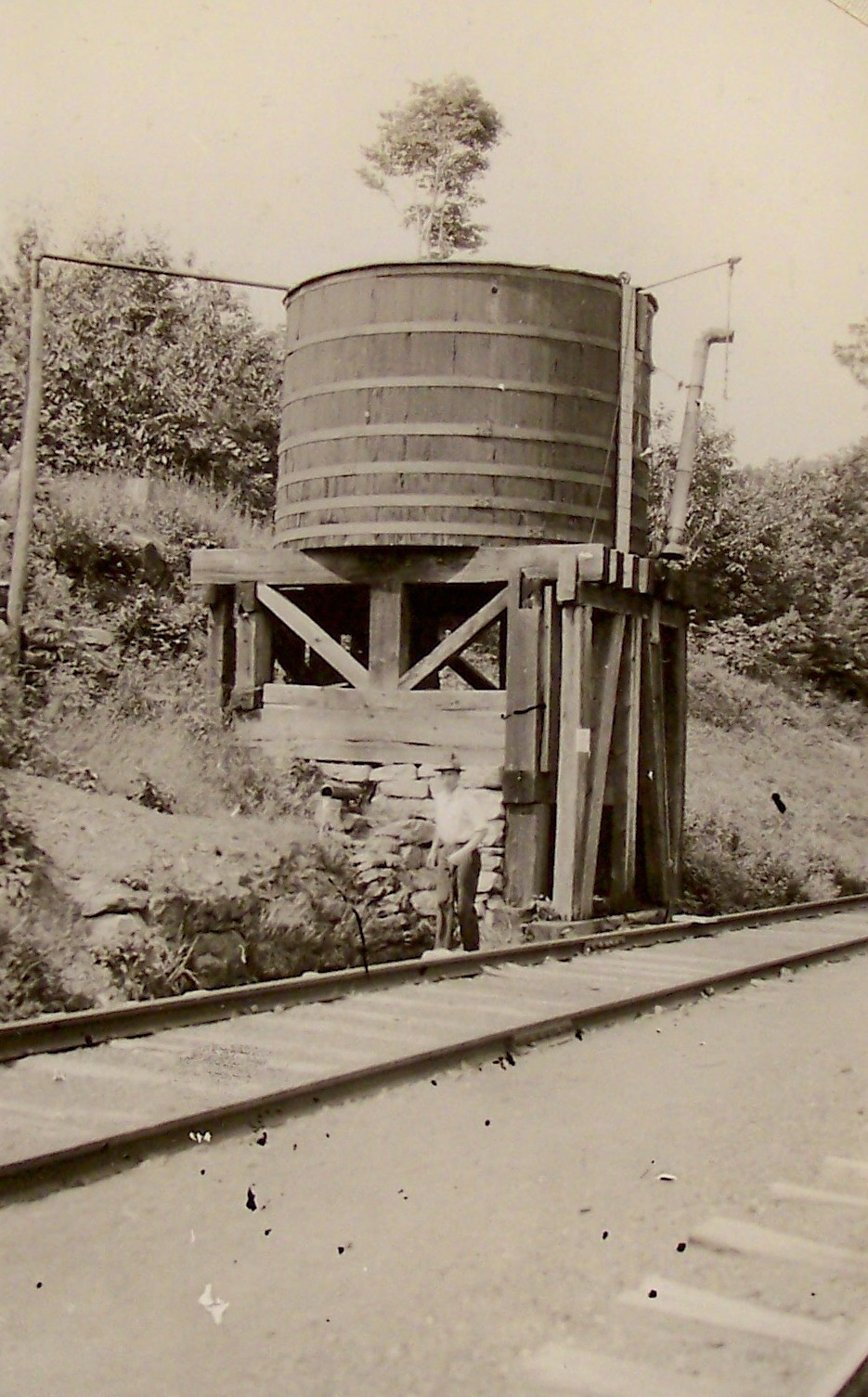
Elizabethville‘s water tank was necessary to re-fill the steam engines that used this route. The above photo appeared in the Elizabethville Sesquicentennial Book and was dated 1918. The photo location was given as “East of Campgrounds, South of Bender Street.”
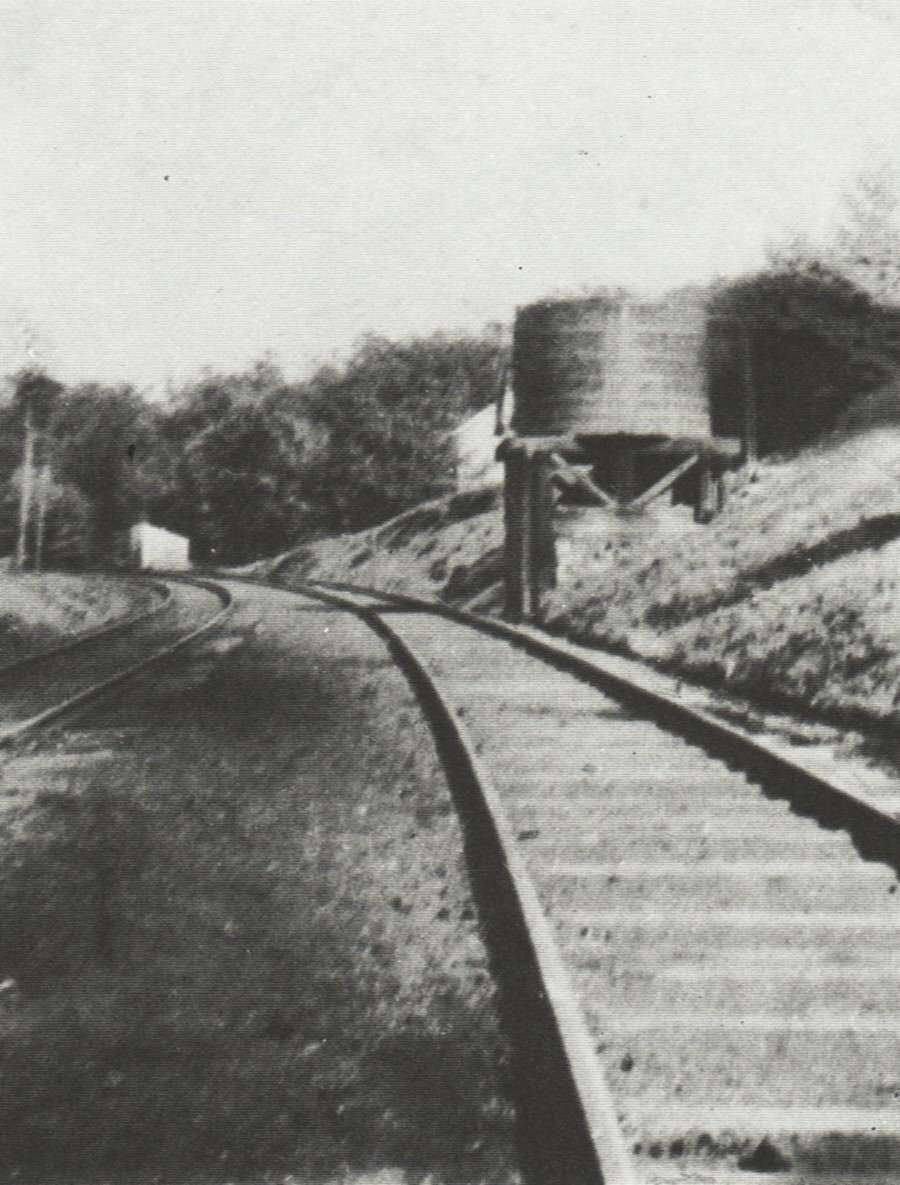
The 1916 photograph from the Interstate Commerce Commission shows the same water tower but gives its location as “at the Elizabethville Campgrounds.”
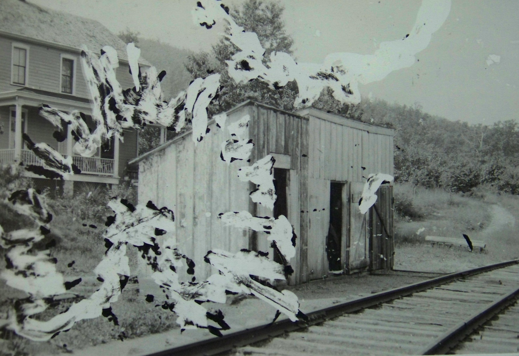
Finally, the above badly damaged photo pictures the trackside tool sheds which are supposedly to the left of the water tower. Source: Interstate Commerce Commission, Washington, D.C.
The water tower and the tool sheds may be post-Civil War additions structures.
There are no known photos of the 1858 railroad station that were taken during the Civil War.
Readers are invited to comment on this post.
———————————–
The Elizabethville Sesquicentennial Book is available in DVD format at the web site for the Elizabethville Bicentennial Committee on their merchandise page.


Comments