 ;
;
Jebediah Hotchkiss, Confederate Mapmaker, and Lykens Valley School Teacher?
Posted By Jake Wynn on July 13, 2013
Few men were as important to the Army of Northern Virginia as Jebediah Hotchkiss. Hotchkiss had served the army throughout the war, and gain notoriety with “Stonewall” Jackson as a mapmaker. In early 1863, thirty-five year old Hotchkiss was given the task of sending scouting parties to map the Shenandoah and Cumberland Valleys from Virginia to Harrisburg, PA. The suggestion was, even at that early date, that a movement northward may be the plan for the summer of ’63.
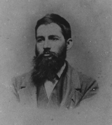
Jebediah Hotchkiss
Hotchkiss sent men north in civilian clothes, sketching the Pennsylvania countryside to bring back to their captain, the chief mapmaker of the Confederate Army. The result was a map that showed much of the south-central Pennsylvania countryside, and which would help the Confederates move northward with some idea of the ground they may encounter.
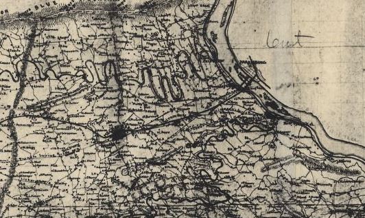
The area of Harrisburg in his 1863 map
But, it seems that Hotchkiss may not have been as unaware of the Keystone State’s terrain as some of his Virginia colleagues.
Jebediah Hotchkiss was born in Windsor, New York during latter half of 1828. In the small community near Binghampton, tucked along the Susquehanna River and the mountains of central New York, Hotchkiss attended school until he was 18.
Hotchkiss seemed to take up an interest in teaching and by the summer of 1846 he had earned his first teaching job. He had headed south from his New York home towards the Pennsylvania anthracite region, and had settled into the tight-knit community of the Lykens Valley. What happened during his time in the Lykens Valley is relatively unknown. However, it appears he may have taken an interest in the field of engineering, especially in that of mining.
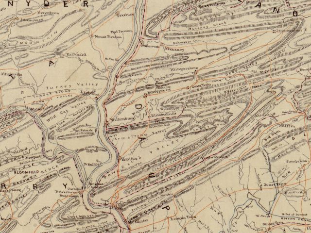
He made this map of Pennsylvania during the war, here is the section upper Dauphin County which he probably knew very well.
His diary records a trip to Harrisburg in the summer of 1847, as he left the Lykens Valley headed for the mountains of Virginia. His diary reveals an interesting irony in the route he took. He discusses his time in the capital, before heading out across the Susquehanna River and down the Cumberland Valley to Carlisle and then into Maryland. This would be the same route Robert E. Lee would choose to invade Pennsylvania, using the maps Hotchkiss had drawn up.
Following the Civil War, nearly all his maps were saved and utilized in the official reports of the War of the Rebellion. Today, they reside in the Library of Congress and can be accessed online here.
After the war, Hotchkiss continued teaching in a school he founded before the war in Staunton, Virginia. He also began work as a consultant for mining companies in western Virginia, mostly as an engineer. This interest in the field of mining may very well have developed in 1846, while he spent time in the lucrative coal fields of the Lykens Valley.
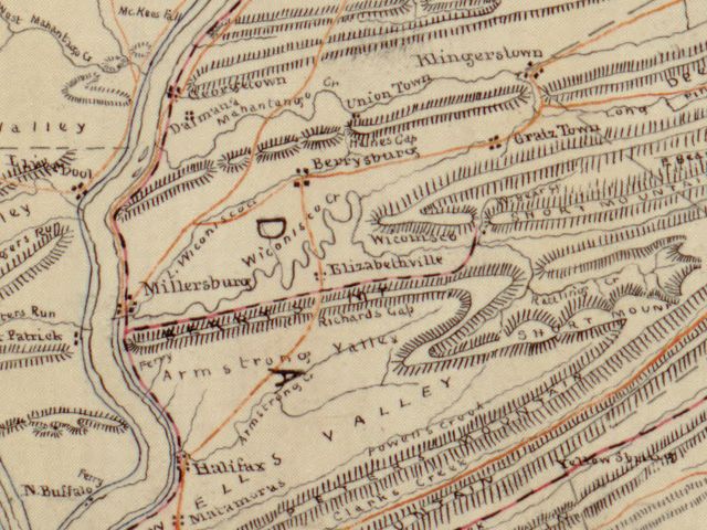
Close up view of the same map
Hotchkiss died in 1899 at the age of 71. He is buried in his adopted Virginian hometown of Staunton.


Comments